

Wiltshire, United Kingdom · United Kingdom
- Two chalk landscapes in Wiltshire, about 24 kilometres apart, hold circles, avenues, barrows, and henges built and used from about 3700 BC to about 1600 BC.
- Stonehenge is the most architecturally elaborate prehistoric stone circle known, and Avebury is the largest, within a bank and ditch 1.3 kilometres around.
- Silbury Hill was raised around 2400 BC, and West Kennet Long Barrow is the largest known Neolithic stone-chambered collective tomb in southern England.
- The monuments were aligned on the sun, used for burial and ceremony, counted as a wonder in the twelfth century, and inscribed together in 1986.
- Work published in 2025 confirmed that the great ring of pits around Durrington Walls is human-made and Late Neolithic, and 2024 digging beside Avebury Manor found Mesolithic flint but almost no Neolithic settlement.
Visiting
The stone circle near Amesbury is open Monday to Sunday from 9.30am to 5pm, and last entry is at 3pm. Tickets booked online before midnight on the day before the visit cost less than tickets bought on the day. A ticket is valid all day within opening hours. Entry is free for members of the organisation that manages the monument, and entry is also free for members of the charity that owns the surrounding land.
General admission should be booked in advance. Separate tickets are sold for a visit inside the stones and for an expert-led landscape tour. On 22 December 2026 the monument is open as normal from about 1pm, and parking for the winter solstice must be booked in advance. The stone circle at Avebury is open from dawn to dusk.
The Alexander Keiller Museum is open from 10:00 to 16:00, and admission is charged. Avebury Manor house is open from 11:00 to 16:00, and adult admission is £14, or £15.40 when a voluntary gift is added. The manor garden is open from 10:00 to 16:00, and adult garden admission is £7. Adult museum admission is £7, and entry is free for children under 5.
Tour tickets at 12:00, 13:00, 14:00, and 15:00 cost £6 for an adult and £3 for a child, subject to availability. From 25 June to 1 September 2026 a temporary tax change may make the admission taken at the till lower than the advertised ticket price. Entry is free to the land on the west side of the toll road at Durrington Walls. West Kennet Long Barrow is open all year and entry is free.
The Sanctuary is open all year and entry is free.
History
Stonehenge, Avebury and Associated Sites is a pair of chalk landscapes in Wiltshire, separated by about 24 kilometres. Avebury lies about 17 miles north of Stonehenge. The two parts were inscribed together in 1986, at the 10th session of the World Heritage Committee, and the Avebury boundary was extended in 2008.
The property was listed for monument complexes built and used from about 3700 BC to about 1600 BC. Stonehenge is the most architecturally elaborate prehistoric stone circle known, and Avebury is the largest. More than 700 archaeological features have been identified, within 160 scheduled monuments.
Before the monuments, the hills carried oak woodland that farmers gradually opened into grassland. Around 8000 BC, pine posts stood near the later circle. At Blick Mead, a year-round spring, people lived from 6250 to 4700 BC and left thousands of sharp flint tools, including three tranchet axes.
In 2024, digging in the parkland between the henge and Avebury Manor found Mesolithic flint and very little Neolithic settlement, which has been read as a reserved space beside the monument. The same season at Cherhill, west of Avebury, a later Mesolithic spring preserved footprints of wild cattle and deer. A Middle Neolithic rubbish deposit there belongs to herding communities living near the time the first great monuments were raised.
Windmill Hill, the largest known causewayed enclosure in Britain, was ditched around 3700 BC. West Kennet Long Barrow, probably built in the thirty-seventh century BC, is the largest known Neolithic stone-chambered collective tomb in southern England. The Stonehenge Cursus was dug between 3630 and 3375 BC, centuries before the circle.
Stonehenge began as a bank and ditch around 3100 BC and may have been a burial place from the start. The sarsen circle, with lintels locked by mortise and tenon, was raised between 2600 and 2400 BC. Bluestones from Pembrokeshire, carried as much as 240 kilometres, stand in their present positions between 2400 and 2200 BC, and the ruined circle aligns on summer sunrise and winter sunset.
The Avenue joins the circle to the River Avon. Durrington Walls, about 2 miles north-east, held a large Late Neolithic village and a timber circle before and during the building of its bank. Research set out in November 2025 confirmed that a ring of pits more than 2 kilometres wide around Durrington Walls and Woodhenge is human-made and Late Neolithic.
Avebury's bank and ditch run for 1.3 kilometres and once held 180 local stones in three circles. Avenues linked the henge toward the Sanctuary and toward Beckhampton. Silbury Hill, a white chalk mound of the centuries around 2400 BC, is given as 39.3 metres high in one account and 39.5 metres in another.
Normanton Down carries the densest concentration of burial mounds, including Bush Barrow, where a man was buried about 1950 BC with gold and bronze. By the Iron Age, Avebury had been largely abandoned, and a village later grew in among the stones. In the twelfth century Henry of Huntingdon and Geoffrey of Monmouth counted Stonehenge among the wonders of the world.
John Aubrey and William Stukeley recorded both circles as stones were being broken for building. Avebury Manor, on the site of a small monastery founded in 1114, was bought in 1551 by William Dunch because of the ancient monuments, and Alexander Keiller restored it in the 1930s while he rebuilt much of the circle. Fallen stones elsewhere were reset in the early and middle twentieth century.
In 2013 the road that had cut the Avenue beside the circle was closed, and a visitor centre for the wider landscape opened. Another trunk road still harms the Stonehenge setting, and traffic still passes through Avebury. A condition survey of 995 monuments, in the field from October 2023 to February 2024, is guiding the next management plan, while chalk grassland is being restored and a new learning centre has been started.
Images




Detailed History
Stonehenge, Avebury and Associated Sites is a World Heritage property on the chalk of Wiltshire. It is not one building. It is two landscapes, separated by about 24 kilometres, or 15 miles. Avebury lies about 17 miles, or 27 kilometres, north of Stonehenge.
One account gives the Stonehenge part as 26 square kilometres and the Avebury part as 22.5 square kilometres. Another describes each landscape as about 25 square kilometres, and the Avebury monuments as covering about 8.75 square miles, or 23 square kilometres. The inscribed area is given both as 4,985.4 hectares, or 12,319 acres, and as 5,152.39 hectares. The two parts were inscribed together in 1986, at the 10th session of the World Heritage Committee.
A minor boundary change was inscribed in 2008, extending the Avebury part to take in East Kennet Long Barrow and Fyfield Down, with its Bronze Age fields and naturally occurring sarsen stones.
The World Heritage Committee chooses the places that enter the World Heritage List and the list of properties in danger, and it allocates assistance from the World Heritage Fund when states parties ask. Twenty-one states parties sit on it. The convention sets a term of six years, and many states cut that to four so that others can serve. The committee meets once a year.
Advisory bodies help its discussions. This Wiltshire property was listed for complexes of prehistoric monuments, and for what they show of ceremony and burial across about 2,000 years of building, from circa 3700 BC to circa 1600 BC. Stonehenge is the most architecturally elaborate prehistoric stone circle known. Avebury is the largest.
More than 700 archaeological features have been identified across the property. There are 160 separate scheduled monuments, covering 415 items or features. Ownership in the Stonehenge part is shared by English Heritage, the National Trust, the Ministry of Defence, the Royal Society for the Protection of Birds, Wiltshire Council, and private farmers and households. About a third of the whole property is owned and managed by conservation bodies.
Much of the rest is reached by public rights of way, permissive paths, and access tied to farming schemes that restore grass and hold back scrub. About 480 people live in 235 homes in Avebury and Avebury Trusloe, with more households in Beckhampton and West Kennett.
The chalk country was not always open grassland. Around 4250 to 4000 BC the soils of lowland Britain were changing. Mesolithic woodland here was dominated by alder, lime, elm, and oak. Pollen falls sharply around 4500 BC, grasses increase from 4500 to 3200 BC, and cereal pollen appears.
Pollen survives badly in the chalk, so snail shells, which track habitat, are the better local record. In the early Neolithic the hills around Avebury were still dense oak wood. As the Neolithic went on, that wood retreated and grassland took its place, much of the clearance made by farmers. Joshua Pollard and Andrew Reynolds wrote that by the mid-fourth millennium BC the landscape around Avebury was being stealthily transformed.
The early farming economy in Britain looks largely pastoral. Between about 4500 and 3800 BC communities took up agriculture after contact with the continent, whether by migration or by adoption, and permanent houses and cereal plots are scarce. People seem to have herded cattle and moved, or half-moved, with the herds.
The oldest dated activity in the Stonehenge landscape is older than the bank and ditch. Four, or possibly five, large postholes, one of which may be a natural tree throw, lie under the tourist car park that was used until 2013. They date to about 8000 BC. The posts were pine, about two feet six inches, or 0.75 metres, across, and they rotted where they stood.
Three, and possibly four, stood in an east-west line, which may have been deliberate. A settlement that may be of the same age stood at Blick Mead, a spring that runs all year, about one mile, or 1.6 kilometres, from the later circle. Occupation there is dated from 6250 to 4700 BC. The first finds were Mesolithic tools.
A feature once taken for a pond was an ancient spring that may have belonged to a seasonal lake. A metre of domestic waste suggests a considerable population after the banks of the neighbouring hill were built. In 2010 a layer about 12 centimetres thick produced about 10,000 pieces of struck flint and more than 300 pieces of animal bone. The flint was still sharp enough to cut a hand.
The tools include microliths, backed blades, burins for bone and antler, notched tools, scrapers, cores, and waste from every stage of knapping, plus three tranchet axes. Only five tranchet axes had been found before on the whole of Salisbury Plain. One tool is worked slate, a stone that does not occur locally. Professor Tim Darvill called this the most important discovery at Stonehenge in many years.
It has been suggested that the hill belonged to the ritual landscape in the later part of that Mesolithic span.
The same early human presence appears around Avebury. Fieldwork finished in 2024 in the parkland between the henge and Avebury Manor, work begun to look for Neolithic settlement beside the monument. Neolithic traces were scarce. The excavators read that scarcity as a reserved space, perhaps a sacred one, kept clear of houses while the henge was in use.
They did find Mesolithic worked flint, and later material from the medieval village and the manor after 1550, including an early Anglo-Saxon pit. The trenches also help to follow the village from the early Saxon period to the laying out of a formal park around 1700. The same season, at Cherhill, about 4 kilometres west of Avebury, a later Mesolithic tufa spring, about 8,000 to 7,000 years old, preserved footprints of wild cattle and deer in what had been soft mud, with flint, butchered bone, and antler tools. That kind of preservation is unusual in Britain.
A second trench held Middle Neolithic rubbish, flint, bone, and pottery, in a dark soil in a natural hollow. The excavators asked whether pastoralists living there, near the time the first phases of the two great monuments were built, took part in the building. A Roman site at Springfield was examined in the same season.
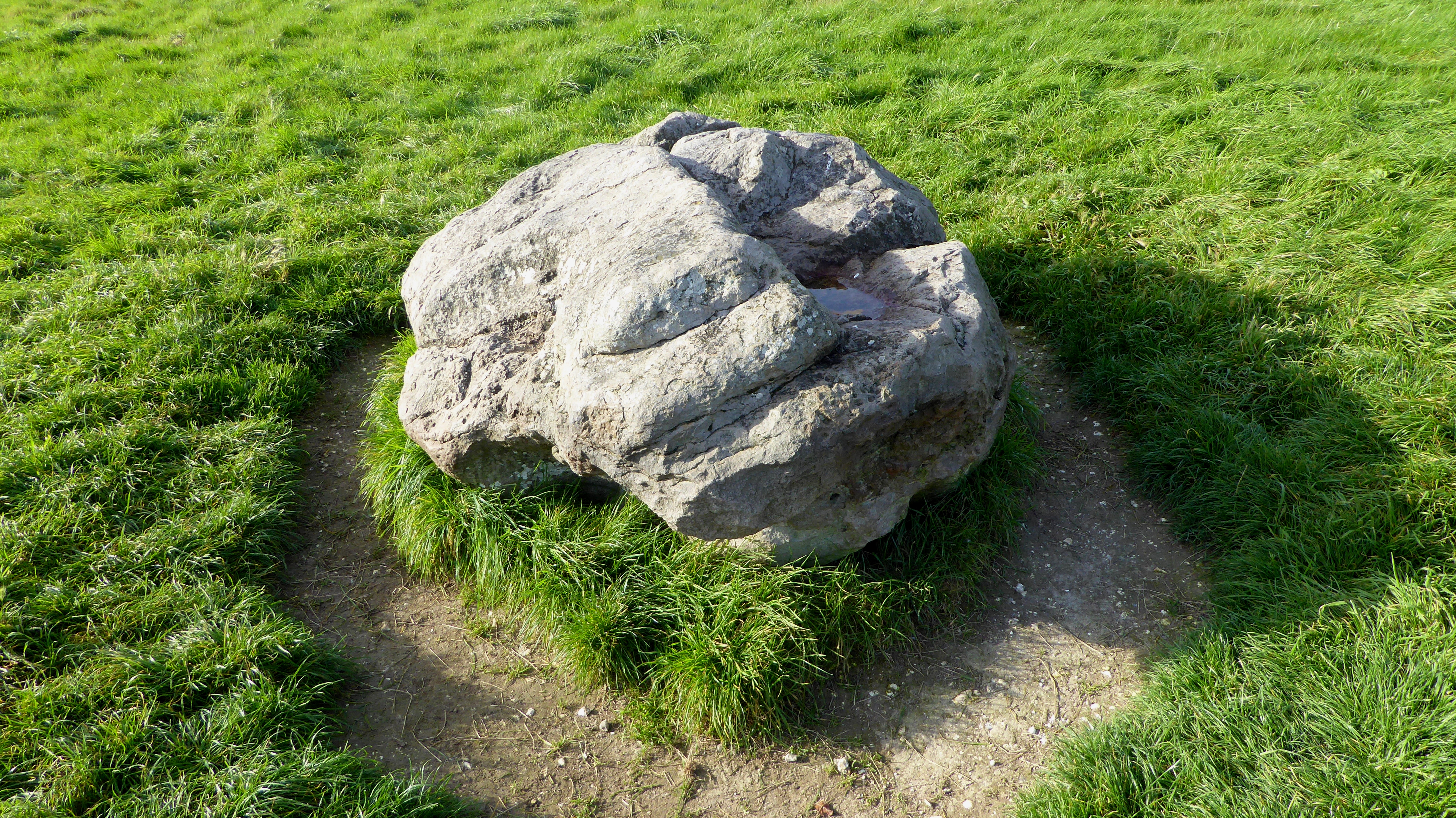
The Cuckoo Stone is a fallen sarsen of the same kind as the largest stones at Stonehenge. It lies near Woodhenge and Durrington Walls, about 2.5 kilometres north-east of the circle, and Richard Colt Hoare marked it on his map of 1810. Excavation in 2007, during the Stonehenge Riverside Project, found the pit just to the west. The stone had been a natural boulder.
Sometime before 2000 BC it was set upright, after a wooden post had stood in the same pit. Around 2000 BC it became a focus for cremation burials. In the Roman period a rectangular building stood to the south-west, with pits and scattered coins, and it is read as a small shrine.
About 12 metres north-west of Coneybury Henge, a pit known as the Coneybury Anomaly held a mass of early Neolithic pottery, a large quantity of animal bone, and flint of both Mesolithic and Neolithic types. The excavators read it as a gathering of a regional community, people from different cultures and places, a feast held long before the henge. Coneybury Henge itself is about 1.4 kilometres east-by-southeast of Stonehenge, with a view south-east over the Avon valley and west toward Normanton Down. Ploughing has flattened it.
Aerial photographs in the 1920s first showed it, at first as a disc barrow. Later pictures showed an oval ditch about 45 by 55 metres and a north-east entrance. Excavation in 1980, in the Stonehenge Environs Project, found a ditch about 4 metres wide and 3 metres deep, pits, postholes, stakeholes, and an arc of postholes that may have been a post circle. Some internal features may be older than the bank.
Pottery runs from the early Neolithic to the middle Bronze Age, with animal bone and a human cremation. Ridge and furrow on some photographs suggests the earthwork was already slight in the medieval period or soon after. No early written description mentions it.
The first large enclosures belong to the centuries around 4000 to 3300 BC. Windmill Hill, about a mile north-west of Avebury, is the largest known causewayed enclosure in Britain, about 21 acres, or 8.5 hectares. The only sign of a first occupation, around 3800 BC, is a series of pits of an agrarian community using Hembury pottery. Around 3700 BC three concentric rings of segmented ditch were cut.
The outer ring is 365 metres across. Causeways break the ditches at widths from a few centimetres to 7 metres. Spoil made internal banks, largest on the outside, and a rectangular mortuary enclosure stood in the same period. Alexander Keiller bought the hill in 1924 and, with Harold St George Gray, dug it from 1925 to 1929.
That work made it the type site for these enclosures, then called causewayed camps. Pottery from the ditch bottoms defined the Windmill Hill style. Later fills held Peterborough ware, then Mortlake and Fengate styles, and large amounts of human and animal bone. Grooved ware and Beaker sherds show use through the rest of the Neolithic.
A Bronze Age bell barrow was built between the inner and middle rings. More digging followed in 1957 and 1958. The hill was scheduled in 1925, passed to the National Trust in 1942, and is in English Heritage guardianship. In April 2025 the hundredth year since Keiller's excavations began was marked.
Robin Hood's Ball lies about 2.5 miles north-west of Stonehenge, outside the northern boundary of the property. It is a causewayed enclosure of two ditch circuits and one causeway, probably built around 4000 BC and perhaps used until about 3000 BC. When it was new, the cursus, Durrington Walls, and Stonehenge did not yet exist. The name has nothing to do with the outlaw.
Nineteenth-century maps give Robin Hood's Ball to a round copse, and the earthwork was then called Neath Barrow. It was scheduled in 1965. It has never been fully excavated. The statement of the property's value says the Stonehenge boundary should be reviewed with nearby monuments such as this one in mind.
West Kennet Long Barrow, also called South Long Barrow, was probably built in the thirty-seventh century BC. It belongs to the Cotswold-Severn group, one of about thirty long barrows on the uplands of northern Wiltshire, of which about seventeen were chambered. The mound uses earth, local sarsen, and oolitic limestone brought from the Cotswolds, with kerb-stones around a sub-rectangular tumulus. Human bones went into the chamber probably between 3670 and 3635 BC, men, women, and children together.
Burial then seems to pause for more than a century. Between 3620 and 3240 BC the chambers were used again for human and animal remains, flint, and pottery. In the Late Neolithic the entrance was blocked with large sarsens. The barrow is the largest known Neolithic stone-chambered collective tomb in southern England.
A small coin hoard was buried in its flank in the Romano-British period. Antiquaries noticed the ruin in the seventeenth century. It was dug in 1859 and again in 1955 to 1956, then partly rebuilt. It is open without charge all year.
It stands on a crest above the upper Kennet and looks north to Avebury. Chambered tombs of this broad family were raised along the Atlantic edge of Europe in the early Neolithic, and the tradition reached Britain from the continent in the first half of the fourth millennium BC.
The Stonehenge Cursus, also called the Greater Cursus, is about 3 kilometres long and between 100 and 150 metres wide, aligned roughly east to west. An antler pick from the base of the western terminal ditch dates the digging to between 3630 and 3375 BC, several centuries before the first phase of Stonehenge. That first phase is placed at about 3100 BC in one account and at about 3000 BC in another. The ditches vary.
Eastern and southern stretches can be only 0.75 metres deep and 1.8 metres wide, while the western terminal is about 2 metres deep and 2.75 metres wide. The long axis points at sunrise on the spring and autumn equinoxes. A Neolithic long barrow stands at the eastern end, and a later Bronze Age round barrow sits inside the western end. The cursus crosses the dry valley called Stonehenge Bottom, perhaps a winterbourne when it was built.
Its use is unknown. It has been read as ceremonial, and as a boundary between living areas and ceremonial ground. Two pits near the ends line up with midsummer sunrise and sunset through the later circle. William Stukeley was the first to record the earthwork, and he took such monuments for Roman racecourses, which is why a Latin word for a racecourse became the name.
The eastern long barrow was noted by Stukeley in 1723 and by Colt Hoare in 1810. John Thurnam dug it in 1868 and found an ox skull and secondary burials. It is now levelled under a bridleway on King Barrow Ridge. Julian Richards and the Stonehenge Environs Project dug the eastern ditch in the 1980s and found nothing they could date.
The Riverside Project dug it again in 2008. A 1979 recommendation to move the bridleway and clear the wood has not been carried out. South of the western end, the Cursus Barrows run about 1,200 metres along a ridge and about 250 metres wide. The Lesser Cursus, 750 metres north-west of that western end, is about 400 metres long and 60 metres wide.
Ploughing since the Second World War has left it as a cropmark. It has been scheduled since 1925.
Stonehenge stands on Salisbury Plain, two miles west of Amesbury, inside the densest complex of Neolithic and Bronze Age monuments in England, among several hundred burial mounds. The first monument is a circular bank and ditch of about 3100 BC. Human bone was deposited from as early as 3000 BC, when that circuit was dug, and for at least 500 years after, so a cemetery is possible from the start. Mike Parker Pearson, who led the Riverside Project, wrote that Stonehenge was a place of burial from its beginning to its height in the mid third millennium BC, and that a cremation of the sarsen phase is probably one of many, the circle still a domain of the dead.
Building then runs for at least 1,500 years, and wider construction in the landscape may stretch the story toward 6,500 years. Dating is difficult because periglacial churning and animal burrows have disturbed the chalk, because early dig records are poor, and because secure scientific dates are still uneven. The great sarsen circle was raised between 2600 and 2400 BC. Each outer sarsen is about 13 feet, or 4 metres, high, about 7 feet, or 2.1 metres, wide, and around 25 tons.
Lintels are locked on with mortise and tenon, a joint not known on other monuments of the time. Inside them is a ring of smaller bluestones, and inside that stand the trilithons, two heavier uprights and one lintel. The largest stones weigh over 40 tonnes. The building uses Wiltshire sarsen and bluestone from Pembrokeshire, carried as much as 240 kilometres.
The bluestones stand in their present holes between 2400 and 2200 BC on radiocarbon dates, though they may have arrived as early as 3000 BC. Work continues until about 1600 BC. The ruined circle is aligned on sunrise at the summer solstice and sunset at the winter solstice. The word henge, taken from this place, is now used for a circular bank with an internal ditch, a later archaeological label borrowed from antiquarian language.
The name itself is older. Aelfric's tenth-century glossary gives henge-cliff the sense of a precipice, or a stone, and eleventh-century writers record stanenges or Stanheng, not far from Salisbury, as stones held in the air.
The Avenue is nearly 3 kilometres long and joins the circle to the River Avon. It was built in the phase dated 2600 to 1700 BC. Part of it shares the summer-solstice sunrise line, which suggests the season of heaviest use. In 2013 the road that cut it close to the circle was closed.
Under the lifted surface the banks had been sliced off, but the filled ditches remained, so the avenue does run through to the stones. At the river end a ring of pits called Bluestonehenge was found in 2009. No standing stones were in it, and chips once taken for bluestone were later shown to be unrelated to the Stonehenge stones. Beneath the avenue, ice-age stripes run in parallel grooves.
Parker Pearson has argued that the avenue was laid over those natural lines because they already pointed at the solstice, and that this is why the circle was raised here. The circle and the avenue were protected by the Ancient Monuments Protection Act of 1882. The stones are owned by the Crown and managed by English Heritage. The surrounding land belongs to the National Trust.
Durrington Walls, about 2 miles north-east of the circle, is a settlement later wrapped in a henge. The visible ridge is the worn inner face of the bank and the outer face of the ditch. The ditch was about 5.5 metres deep, 7 metres wide at the bottom and 18 metres at the top, and the bank reached 30 metres wide in places. Entrances lay at the north-west and south-east, with possible further gaps to the south and north-east that may have been blocked on purpose.
The enclosure sits on ground that falls south-east toward a bend of the Avon, and the south-east entrance is about 60 metres from the river. Around 2600 BC a timber circle, now called the Southern Circle, was built inside, facing south-east toward midwinter sunrise, with four concentric rings of very large posts. A paved avenue on a slightly different line, toward summer-solstice sunset, led to the river, and a great timber post stood on that line, about as far from the circle as the Heelstone stands from Stonehenge. A village then grew, probably after the circle and the avenue.
Between 2004 and 2006 excavators from the University of Sheffield found seven house floors, some of them under the later bank, so people lived here before the bank was thrown up. One house had a cob wall and a smaller outbuilding, and its plan has been compared with a house at Skara Brae. The others seem to have had wattle and daub walls. If the whole enclosure was lived in, there may have been up to 1,000 houses and perhaps 4,000 people, for about 500 years beginning sometime between about 2800 and 2100 BC.
For a short time it may have been the largest settlement in northern Europe. From 2010 to 2014 survey traced a henge about 500 metres across, largely of timber, read as a complement to the stone circle. One account calls Durrington Walls the largest known henge in Britain. Another calls it the second-largest Late Neolithic palisaded enclosure in the United Kingdom, after Hindwell in Wales.
An old toll road and a banked road built in 1967 cross the henge. Barracks once stood at the north-eastern end, and houses were built on the western bank. The land west of the toll road belongs to the National Trust, and entry there is free.
In 2020 geophysical survey found a circuit of pits around Durrington Walls and Woodhenge. Some are natural sinkholes. Others seem to have been enlarged for massive timbers. That reading gives a ring about 1.2 miles, or 1.9 kilometres, across, of pits about 10 metres wide, which would be the largest prehistoric monument in Britain if the reading is right.
Research set out on 24 November 2025, led by Vince Gaffney, tested the pits with boreholes, sediments, chemistry, optically stimulated luminescence, and environmental DNA. Early results say the pits are human-made and Late Neolithic, from about the time the henge was built. Most are 4.5 to 6.9 metres deep. The ring is also described as more than two kilometres wide, enclosing more than three square kilometres, with pits up to 10 metres across and five metres deep.
Fine clay and silt suggest a slow fill. Plant DNA and soil chemistry show what grew nearby. Gaffney said the shafts have no precedent in Britain, and that they were not dug and abandoned. They belonged to a structured landscape, and they may have marked a sacred boundary around the ceremonies at Durrington Walls.
The work belongs to the Stonehenge Hidden Landscapes Project.
Woodhenge, 2 miles north-east of Stonehenge, is a Class II henge and a timber circle. Early in the nineteenth century it was an earthwork called Dough Cover, thought to be a disc barrow. Gilbert Insall photographed it from the air in 1926, while Alexander Keiller and O. G.
S. Crawford were flying surveys over Wessex. Crawford gave the discovery to Insall. Maud Cunnington and Ben Cunnington dug from 1926 to 1929 and showed it was a henge.
Six oval rings of postholes, the outer about 43 by 40 metres, sit in a flat-bottomed ditch up to 12 metres wide and 2.4 metres deep, inside a bank about 10 metres wide and a metre high. The whole monument is about 110 metres across, with one entrance to the north-east, roughly toward midsummer sunrise. The timber rings are close in diameter to the stone rings at Stonehenge. Grooved ware and later Beaker pottery were found.
The ditch dates between 2470 and 2000 BC, around the sarsen circle or a little later, and the place was still used around 1800 BC. At the centre lay the crouched body of a child. Maud Cunnington read the broken skull as a dedicatory sacrifice. Later opinion allows that the weight of the soil may have split the bone.
The remains were taken to London and destroyed in the Blitz, so they cannot be tested again. Concrete posts now mark the holes. The timbers were probably free-standing, not the posts of a roof. In 1966 the Southern Circle was found 70 metres to the north, inside Durrington Walls.
The stone circle, the Avenue, Woodhenge, and the Southern Circle with its avenue still keep a solstice alignment.
Avebury is a henge containing three stone circles, raised over several hundred years in the third millennium BC. The bank and ditch run for 1.3 kilometres. Within them, 180 local, unshaped stones made one great outer circle and two smaller inner circles, entered at four places. The first purpose is unknown.
It is thought to have been ceremonial. By the Iron Age the monument was effectively abandoned, with some use in the Roman period. In the early Middle Ages a village grew round the stones and then into them. In late medieval and early modern times people broke many stones, both from religious motive and for building material.
John Aubrey and William Stukeley recorded what survived between those losses. In the twentieth century Harold St George Gray dug the bank and ditch, and Alexander Keiller oversaw a reconstruction of much of the circle. The National Trust manages the monument. It is a scheduled ancient monument.
The henge stands on a low chalk ridge about 160 metres above the sea, in the upper Kennet, about 6 miles from Marlborough and 7 from Calne.
The West Kennet Avenue was two lines of stones, 25 metres apart and 2.5 kilometres long, from the henge to the Sanctuary. About 100 pairs are thought to have stood, a date around 2200 BC coming from Beaker burials under some of them. Twenty-seven stones still stand, and 37 concrete pillars mark empty sockets. Between the thirteenth and seventeenth centuries many stones were buried or smashed for building.
Maud Cunnington set one upright again in 1911. Keiller and Stuart Piggott restored the northern third in 1934 and 1935. From 2013 to 2015 Joshua Pollard and Mark Gillings returned to a settlement scatter Keiller had found in 1934 and recovered 16,399 pieces of worked flint, from the Mesolithic to the Early Bronze Age. The avenue is owned by the National Trust and is in English Heritage guardianship, and the two bodies share the cost of its care.
The Beckhampton Avenue curved south-west from Avebury toward the Longstones at Beckhampton, probably in the late Neolithic and early Bronze Age. Only Adam still stands. Even in the early eighteenth century Stukeley could see little on the surface. Other stones were likely broken and sold.
In 2000 the University of Southampton uncovered 120 metres of paired stone-holes, set about 15 metres apart, in the pattern of the Kennet Avenue. Stukeley imagined the two avenues as one snake, head at the Sanctuary, body through Avebury. The line may have run past the Longstones, and Adam may belong to a cove on that line. Eve stands on the way back to the western entrance, along what is now the village street.
A causewayed enclosure had occupied the ground before the avenue.
The Sanctuary, on Overton Hill, was stone and timber. Digging found 58 stone sockets and 62 post-holes. It looked over the older barrows of West Kennet and East Kennet, and the avenue tied it to Avebury across more than 2 kilometres. It also lies near the Ridgeway and near Bronze Age barrows.
Stukeley drew the stones early in the eighteenth century. Farmers destroyed them in the 1720s. Maud and Ben Cunnington excavated in 1930, and concrete posts mark the timber positions. Aubrey Burl called those markers dull.
Pollard and Reynolds wrote that the place is far from the most spectacular Avebury monument, and that its importance should not be missed. It is open without charge all year. A main road separates it from the barrows on the hill.
Silbury Hill is the chalk mound beside Avebury, in the care of English Heritage. One account gives the height as 39.3 metres, or 129 feet, and calls it the tallest and the second largest prehistoric man-made mound in Europe, close in volume to the pyramids of its age. Another gives 39.5 metres and calls it the largest prehistoric mound in Europe, half a million tonnes of chalk, raised around 2400 BC. The base is a circle 167 metres across, the flat top 30 metres across, and the mound covers about 2 hectares.
Stages between about 2400 and 2300 BC have been reckoned at 18 million hours, or 500 people for 15 years, to lay 248,000 cubic metres. A smaller mound came first. Around 2400 BC a gravel core was revetted with stakes and sarsen. Chalk from surrounding ditches was then heaped on, and the ditches were refilled and recut farther out.
A step near the summit may have stopped the slope slipping, or it may be what is left of a spiral path for carrying chalk, later walked in procession. The finished hill was white, and the ditch may have held spring water. The purpose is still unknown. Euan MacKie argued that an ordinary tribal society could not have kept up this labour, and he pictured a strict religious elite across southern Britain.
Richard Atkinson, digging from 1968 to 1970, argued for a start near 2750 BC from a radiocarbon date on turf at the base, and for building in chalk steps that were packed and then weathered to a slope. Those radiocarbon dates are not treated as reliable now. The medieval top was flattened for a building, perhaps a defence. John Aubrey drew the hill, and the notes appeared between 1680 and 1682 in Monumenta Britannica.
Stukeley wrote that a skeleton and a bridle were found when a tree was planted on the summit in 1723. In October 1776 Cornish miners under the Duke of Northumberland and Colonel Edward Drax sank a shaft from the top. Letters of Drax, now in the British Library, describe a perpendicular cavity 40 feet, or 12 metres, deep and 6 inches wide. Oak fragments have suggested a tree or a totem pole in that shaft.
Brian Edwards has argued that Drax and his friends, of a poetry circle at Batheaston, dug because they linked the hill with the Greek story of Apollo killing the snake Python. A tunnel was driven from the side in 1849. In 1867 diggers looked for a Roman road under the east flank and did not find it. The road was later found to the south, swerving to miss the mound, so the hill is older than the road and was used as a sight-line.
Flinders Petrie examined the hill after the First World War. Atkinson's work, which was broadcast, produced most of the environmental evidence, including winged ants that mean an August start, and he reopened the 1849 tunnel. After heavy rain in May 2002 the 1776 shaft collapsed and a hole opened in the summit. A seismic survey judged the damage from old digs and the stability of the hill, and repairs were made.
Normanton Down, about 0.6 miles south of Stonehenge, is a cemetery of a Neolithic long barrow and some forty or more round barrows, with burials from between 2600 and 1600 BC. The mounds have stood on the southern skyline since about 2000 BC. Cunnington and Colt Hoare dug several in 1808, including Bush Barrow, and Hoare published the record in 1812. In the east end of the long barrow they found four groups of human remains huddled together.
A rectangular mortuary enclosure south of it, now ploughed flat, was found from the air and dug in 1959. Many of the barrows were scheduled in 1925. Bush Barrow, named for the bushes on it, held a man's skeleton, called the Bush Barrow chieftain, with goods of about 1950 BC: a large gold lozenge, a smaller gold lozenge, a gold belt plate, three bronze daggers, a bronze axe, a stone macehead, and bronze rivets. They are kept at the Wiltshire Museum in Devizes.
The large lozenge is 184 millimetres long, 156 wide, and about a millimetre thick. Its panels repeat hexagons inside three circles. The acute angle of 81 degrees matches the angle between the summer and winter solstices at this latitude, about 51 degrees north. A similar lozenge from Clandon Barrow uses a ten-sided figure.
The land is private, with a bridleway just west of the mound. In 2010 it lay in a reserve where rare birds were being encouraged to breed. Early Bronze Age Beaker graves, often under barrows that have vanished, cluster toward the west of the ridge, near older long and oval mounds.
Vespasian's Camp is an Iron Age hillfort just west of Amesbury, under 3 kilometres from the circle, beside the avenue, with the Avon on the south. William Camden named it in the sixteenth century. Vespasian, emperor from 69 to 79, did campaign in Wessex after 43, but nothing shows he used this hill. The fort is about 730 metres long, about 14 hectares, with a bank up to 6 metres above the ditch and defences up to 68 metres wide.
A medieval road cuts off the southern end. In the eighteenth century the Duke of Queensberry's grounds at Amesbury Abbey took in grotto, paths, and planting, laid out with Charles Bridgeman and others, yet most of the rampart escaped that gardening. A trunk road cut the northern tip in the 1970s. Excavation from 2005 turned to Blick Mead, on the north-east.
Written wonder begins in the twelfth century. Henry of Huntingdon, also called Henry de Huntington, and Geoffrey of Monmouth, also called Geoffrey de Monmouth, counted Stonehenge among the wonders of the world. Henry, born about 1088 and dead about 1157, was archdeacon of Huntingdon and a historian of the secular clergy. Brought up in the household of Robert Bloet of Lincoln, he wrote the Historia Anglorum at the request of Alexander of Lincoln.
It first appeared around 1129 and carries England's history to 1154. Geoffrey, a cleric of Monmouth, born about 1095 and dead about 1155, wrote The History of the Kings of Britain, believed as history well into the sixteenth century and now read as unreliable. The record of his life and book does not itself describe these circles. The wonder is part of the statement of why the property was listed.
Inigo Jones, who lived from 15 July 1573 to 21 June 1652, is named among the early investigators, with Aubrey and Stukeley. Jones was the first major architect of early modern England to use Roman rules of proportion. He designed the Queen's House and the Banqueting House at Whitehall, and he laid out Covent Garden. The record of those buildings does not describe the circles.
John Aubrey was born on 12 March 1626 and died on 7 June 1697. He recorded field monuments across southern England, often for the first time, and he is remembered above all for his survey of Avebury. The ring of pits at Stonehenge called the Aubrey holes carries his name, though it is far from sure that the holes he saw are the ones so named now. His Monumenta Britannica, gathered from about 1663 to 1693, opens with Templa Druidum, on temples he took for druidic, notably Avebury and Stonehenge.
He also began histories of Wiltshire and Surrey and finished neither, and he collected folklore under the title Remaines of Gentilisme and Judaisme. William Stukeley was born on 7 November 1687 at Holbeach and died on 3 March 1765. He was a physician, then an Anglican priest, and a founder figure in the study of both circles. He trained at Bene't College, Cambridge, and at St Thomas' Hospital, practised in Boston in Lincolnshire, and from 1710 to 1725 toured each year for ancient sites.
In 1716 he made a model of Stonehenge. He was elected a Fellow of the Royal Society in 1718, while Isaac Newton was president. Around 1718 he first went to Avebury, with the Gale brothers, perhaps after reading Aubrey's manuscript, and in 1719 he went again and on to Stonehenge, then to Oxford to meet Thomas Hearne, who was sharply critical of him. Through the 1720s he measured both monuments.
In 1721 he became a Freemason, and in 1722 he helped found the Society of Roman Knights. In 1726 he moved to Grantham and married. In 1729 he was ordained and made vicar of All Saints at Stamford. In 1740 he noted that hanging rocks were called henges in Yorkshire, and he took the Saxon name to mean the hanging stones.
One reading of the Old English is stan, stone, with hencg, hinge, because the lintels hinge on the uprights, or with a word for hanging or a gallows.
Avebury Manor stands in the middle of the village, beside the church and close to the henge. A Benedictine cell of the Abbey of Saint-Georges at Boscherville in Normandy was founded here in 1114, and the house occupies that ground or ground beside it. Fragments of the religious house were built into the later walls. In 1411 the estate passed to Fotheringhay College in Northamptonshire.
William Sharington bought it and surveyed it in 1548. William Dunch of Little Wittenham bought it in 1551, it seems because he cared about ancient monuments, and a stone dovecote went up. In the 1580s it passed to his younger son Walter. Walter's daughter Deborah, Lady Moody, grew up in the house, emigrated, and in 1645 founded Gravesend in Brooklyn.
After Walter died in 1594, his widow Deborah married Sir James Marvyn, High Sheriff of Wiltshire in 1596, and around 1601 they rebuilt or extended the south range. In 1640 the family sold the estate to John Stawell. It was sequestered in 1646 when he was accused of treason, sold to George Long in 1652, and given back in 1660 when he left the Tower of London. An eighteenth-century racquets court was added.
In the early twentieth century the family of Leopold Jenner added the west library and remade the gardens. Alexander Keiller, heir to the marmalade makers James Keiller and Son, leased the house in the late 1930s and restored it while he worked on the henge. War in 1939 stopped the digging. In 1955, when a country house was being lost about every five days, he put Avebury Manor on the market.
Sir Francis Knowles bought it, restored it with help from the Ministry of Works, and opened it in May 1956. It was graded I in 1958. Flooding in January 2024 damaged the house badly. It has been restored and has reopened.
The Avebury Papers, from the archive kept with the Alexander Keiller Museum, have been digitised.
Stones that had fallen or been buried were put back on known positions in the early and middle twentieth century, so the plan could be read. Ploughing, burrows, and early excavation have taken a toll, but the survival of earth and stone from between about 3700 and 1600 BC is remarkable. Timber has vanished, and the holes remain. The principal monuments are still in place, and many still command the fields.
Collections from the two landscapes are held at the Alexander Keiller Museum, Salisbury Museum, the Wiltshire Museum in Devizes, the British Museum, the National Museum of Wales, the Museum of Archaeology and Anthropology in Cambridge, and the Ashmolean Museum. Archives are held at the Historic England Archive in Swindon, the Wiltshire and Swindon History Centre in Chippenham, and the Bodleian Library at Oxford. The Bodleian Library was founded in 1602 by Sir Thomas Bodley and is the main research library of the University of Oxford.
Canterbury Cathedral is not one of these monuments. It stands in Kent, inside a separate World Heritage property with St Augustine's Abbey and St Martin's church. Augustine of Canterbury founded it in 597, after Pope Gregory I sent him from Rome. Bede wrote that the missionaries reused a Roman church.
The oldest structure found under the nave in 1993 was Anglo-Saxon, built across a Roman road. Thomas Becket was murdered in the cathedral in 1170. After a fire in 1174 the east end was rebuilt in Gothic for the pilgrims to his shrine. The Norman nave lasted until the late fourteenth century.
The appearance of Canterbury Cathedral among places named with this property is a catalogue of inscribed sites, not a shared past.
Roads cut both landscapes. At inscription, the state agreed to take away the road that split the circle from the Avenue. That closure, and a visitor centre for the wider property, were finished in 2013, and modern clutter was cleared from the immediate setting of the stones. Another trunk road still harms the setting, severs the property, and blocks easy walking to some monuments.
At Avebury, traffic runs through the henge and the West Kennet Avenue. Noise, damage, and roadside clutter continue, and a traffic strategy for that half was proposed. The old rites are not known, but both circles still draw people at the solstice and at other observations, and managed open access is given then. On 22 December 2026, after the winter solstice, the Stonehenge circle is open in the ordinary way from about 1pm.
Parking for the gathering has to be booked ahead if the visitor is not using public transport.
Protection sits in two layers. Monuments, buildings, and landscapes are designated under the Ancient Monuments and Archaeological Areas Act of 1979 and the Planning Act of 1990, and the planning system supplies the second control. The Wiltshire Core Strategy contains a policy for the property and looked forward to a setting study. In 2025 the council adopted a supplementary planning document on that setting, so that new building can be judged against harm to the monuments and their land.
Avebury also lies in the North Wessex Downs, and a management plan for that landscape, covering 2025 to 2030, was launched in November 2025. The 2015 management plan was the first written for both halves together, after workshops, public sessions, and surveys, and it was endorsed by the Department for Culture, Media and Sport. Its concerns are planning, the boundary, conservation, visitors, learning and local stewardship, roads, research, and day-to-day coordination. A condition survey is recommended every ten years.
The latest, commissioned by Historic England and carried out by Wessex Archaeology, assessed 995 monuments, 364 in the Avebury part and 631 in the Stonehenge part. The field season ran from October 2023 to February 2024, after preparation from May 2022. The results are feeding a revision of the plan. Agri-environment schemes continue.
The National Trust has completed a first reseeding of its former arable in the Stonehenge landscape back to flower-rich chalk grass. In October 2025 a local nature strategy was adopted, with further measures for that grassland. In spring 2025 work began on a new learning centre beside the stones. Partners are preparing the fortieth anniversary of the 1986 inscription.
Research frameworks for the property are published and reviewed. Survey and projects such as Between the Monuments keep tying buried remains to standing ones. Grass has to be maintained, and wear from feet and from burrowing animals has to be limited. What remains is a society that could design at a huge scale, move stones across a long distance, set earth and stone to the sun, and change its treatment of the dead over two millennia, from collective stone tombs and cremation grounds to the gold-furnished barrows of the early Bronze Age.
The siting of each work in sight of the others is part of that design. New digging still changes the picture, from the Mesolithic flint beside Avebury Manor to the ring of pits around Durrington Walls.
Sources
- West Kennet Avenue — Wikipedia
- Stonehenge, Avebury and Associated Sites — Wikipedia
- Stonehenge — Wikipedia
- Avebury — Wikipedia
- Silbury Hill — Wikipedia
- Durrington Walls — Wikipedia
- West Kennet Long Barrow — Wikipedia
- Woodhenge — Wikipedia
- Windmill Hill, Avebury — Wikipedia
- The Sanctuary — Wikipedia
- Stonehenge Cursus — Wikipedia
- Stonehenge Avenue — Wikipedia
- Beckhampton Avenue — Wikipedia
- Bush Barrow — Wikipedia
- Avebury Manor — Wikipedia
- Coneybury Henge — Wikipedia
- Cuckoo Stone — Wikipedia
- William Stukeley — Wikipedia
- John Aubrey — Wikipedia
- Stonehenge, Avebury and Associated Sites — UNESCO World Heritage Centre
- Stonehenge, Avebury and Associated Sites — Historic England
- Managing Our Site — Stonehenge and Avebury World Heritage Site
- World Heritage Site Activity 2025-26 — Stonehenge and Avebury World Heritage Site
- New research uncovers secrets of Stonehenge's vast Neolithic pits — University of Bradford
- From Manorial refuse to Mesolithic cattle: fieldwork on two sites at Avebury — University of Southampton
- Stonehenge — English Heritage
- Prices and Opening Times for Stonehenge — English Heritage
- Avebury — National Trust
- Avebury henge and village UK.jpg — Wikimedia Commons
- Engraving of barrow types Colt Hoare Ancient History of Wilthisre 01.png — Wikimedia Commons
- Engraving of barrow types Colt Hoare Ancient History of Wilthisre 02.png — Wikimedia Commons
- Long barrow colt hoare wiltshire.png — Wikimedia Commons
- Pond barrow colt hoare wiltshire.png — Wikimedia Commons
- Lugbury long barrow - geograph.org.uk - 488985.jpg — Wikimedia Commons
- The Cuckoo Stone facing East.jpg — Wikimedia Commons
- The Cuckoo Stone, Wiltshire.jpg — Wikimedia Commons
- Stone in the center of Woodhenge.jpg — Wikimedia Commons
- Barrow Cemetery south of Woodhenge.jpg — Wikimedia Commons