Settlement · Tomb
Maes Howe
Neolithic chambered cairn and passage grave situated on Mainland Orkney, Scotland

Orkney Islands, United Kingdom · United Kingdom
- Maes Howe, also called Maeshowe and, in Old Norse, Orkahaugr, is a Neolithic chambered cairn at Stenness on Mainland, Orkney.
- The mound is about 35 metres across and about 7 or 7.3 metres high today, and it was described as an 11-metre cone before it was opened.
- A low stone passage leads to a square chamber with three side cells, dated around 3000 BC, around 2800 BC, or around 2700 BC in the accounts that differ.
- The passage is aligned on the midwinter sunset behind Hoy, for a few days on either side of the solstice in one account and for nearly three weeks in another.
- Norse visitors in the mid-twelfth century, including men of Harald Maddadsson in a snowstorm in 1153, left the largest runic inscriptions known from one place outside Scandinavia.
- The chamber was emptied in July 1861, taken into state care in 1910, and inscribed in 1999 as part of the Heart of Neolithic Orkney.
Visiting
Access is by guided tour only, and visitors are asked to book in advance online because capacity is limited and a reserved ticket is the sure way to enter. A limited number of extra tickets may be bought on the day of the tour, first come, first served, at the visitor centre. From 1 April to 30 June the cairn is open from 9.30am to 5.30pm on Monday, Tuesday, Wednesday, Thursday and Sunday, and open from 9.30am to 5pm on Friday and Saturday, with tours at 10am, 12 noon, 2pm and 4pm. Last entry in April, May, June and September is at 4.45pm.
In July and August the cairn is open from 9.30am to 8pm Monday to Thursday and open from 9.30am to 5.30pm Friday to Sunday, with tours at 10am, 12 noon, 2pm, 4pm, 5pm, 6pm and 7pm. Last entry in July and August is at 7.45pm. In September the cairn is open daily from 9.30am to 5pm, with tours at 10am, 12 noon, 2pm and 4pm. From 1 October to 31 March the cairn is open daily from 10am to 4pm, with tours at 10am, 12 noon and 2pm.
Last entry from October to March is at 3pm. The cairn is closed on 25 December, 26 December, 1 January and 2 January. An adult ticket for ages 16 to 64 costs £10 when booked online and £11 when bought in person. A concession ticket for a visitor aged 65 or over costs £8 online and £9 in person.
A child ticket for ages 7 to 15 costs £5 online and £5.50 in person. Member admission is free. Filming and photography are not permitted inside the cairn. There is no wheelchair access across the ditch or along the passageway, and a wheelchair is not allowed to enter the cairn.
Assistance dogs are allowed to enter, including inside roofed areas. Visitors with disabilities pay the standard admission, proof of disability is not required, and up to two accompanying carers receive free admission with each transaction. Dogs other than assistance dogs are not allowed. For about six weeks in winter, roughly from the end of November to the middle of January, the setting sun can align with the chamber, and visitors who want to see it should book the 2pm tour ticket.
History
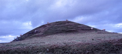
Maes Howe, also called Maeshowe and, in Old Norse, Orkahaugr, is a Neolithic chambered cairn at Stenness on Mainland, Orkney. It stands on a levelled platform within a wide ditch and an outer bank, near the south-east end of the Loch of Harray, with the hills of Hoy closing the view to the south-west. The grass mound is about 35 metres across. Its height is given as 7.3 metres, or 24 feet, and also as about 7 metres, while a description from before it was opened calls it an 11-metre conical tumulus with a hollow in the top.
The date of construction is given in more than one way. Similar tombs cluster around 3000 BC, and this one, being the largest, has been read as the last of that series at about 2800 BC. A timeline for the mound, chamber, bank and ditch uses about 3000 BC. Radiocarbon from trenches dug in 1973 and 1974 is read, more tentatively, as about 2700 BC, and as a terminus ante quem for the ditch rather than a direct date for the raising of the mound.
The builders were late Neolithic farmers in central Orkney, associated with Grooved ware, a pottery that arose in Orkney early in the third millennium BC and later spread across Britain and Ireland. Moving slabs of as much as 30 tons is estimated at about 39,000 hours of labour in one figure, and at least 100,000 hours in Colin Renfrew's calculation. Either figure implies a community large enough to plan a public monument and to fix its axis on the sun.
Under the south side of the platform, excavation in 1991 found a paved path and a drain from an earlier building, perhaps a house, sealed when the glacial knoll was levelled with clay from the loch. At the rear of the mound the same work found the socket of a great standing stone that had been removed. That stone may have belonged to a circle, or it may have stood alone, and the stones reused in the chamber show little weathering.
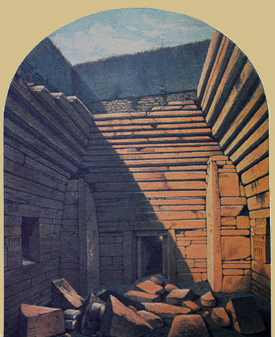
The passage and chamber are built of flagstone. Because the outer passage was ruined when the mound was opened in 1861 and was then rebuilt, its measurements disagree: about 11 metres long and 0.91 metres high, about 15 metres long and up to 1.4 metres high, or, as a visitor meets it now, 10 metres long with an entrance 119 centimetres high and 70 centimetres wide. The chamber is about 4.6 or 4.7 metres square. Its surviving height is given as about 3.8 metres and as about 4.5 metres, and the original roof may have been higher still.
Four corner uprights were built in even though they do not carry the load, and three side cells open off the chamber.
The passage points toward Hoy and the midwinter sunset. One account limits the sunlight in the tomb to a few days on either side of the solstice. Another has the rays in the passage for almost three weeks on either side, crossing the back wall on the solstice itself, and a winter visit can catch the effect across about six weeks from late November to mid-January. The Barnhouse Stone, about 700 or about 800 metres to the south-south-west, stands on the same line.
A 1971 comparison with the Great Pyramid instead reads the passage as a summer-solstice sightline, and cites Alexander Thom's 1967 writing on the geometry. The midwinter alignment argued from Hoy does not depend on Thom's disputed megalithic yard.
Almost no original contents survive, and the notices of bone do not match. Petrie recorded one fragment of a human skull in 1861. A 1931 paper by Marwick said there were several. Later assessments speak of a single lost fragment, or of no confident evidence of human remains at all, and no artefacts of the first use are on record.
Pecked and incised marks around the entrances, including chevrons, crosses and lozenges, are Neolithic, and they match marks in houses and on Grooved ware as well as in other tombs.
The cairn gives its name to a type of Orkney passage grave with a long passage, a square chamber and side cells. One count allows seven certain examples, and Anna Ritchie adds three more that are not named. Maes Howe is the grandest and the least typical. Stuart Piggott called it a superlative monument lifted out of its class by the originality of its execution.
Studies disagree over whether it comes early in that series or at its height.
The mound sits in a landscape of houses and circles. Structure 8 at Barnhouse faces it, and alignments run from the Ness of Brodgar and the Stones of Stenness. Together with Skara Brae and the Ring of Brodgar it was inscribed in December 1999 as the Heart of Neolithic Orkney. A minor boundary change to that designation was inscribed in 2015.
The bank was modified again in the Norse period. An earlier stone wall about 2 metres thick is read as late Neolithic or early Bronze Age, and rubble dumped in the ninth century, or around 950, made the bank seen now. A long cist on the lower east side may be early historic or early Viking. A tenth-century burial in the chamber has been suggested from the bank date and from runes about treasure, and it has also been rejected for lack of direct evidence.
The mound may instead have served as a cult place or as an assembly site.
The twelfth-century break-in has more than one telling. The Orkneyinga saga, compiled in Iceland around 1200, has Earl Harald Maddadsson shelter in Orkahaugr during a snowstorm on the thirteenth day of Christmas in 1153, with four ships and a hundred men, two of whom went insane. Another account puts crusaders of Earl Rognvald Kali in the tomb in 1150 or 1151. A further wording names Harald Maddadsson together with Rognvald, Earl of More.
The medieval entry came through the roof. Runes at floor level show that this was not the only time the interior was reached, and the lettering falls between 1125 and 1175.
Those runes are the largest collection in one place and the largest body that survives outside Scandinavia. The counts are more than thirty, about thirty-three, and at least thirty-three inscriptions with at least eight sketches. They include a boast of the most skilled rune-cutter west of the sea, cut with the axe of Gaukr Trandilsson, a disputed compliment to Ingigerðr, a joke about Ingibjorg the fair widow stooping in, and the line that Jerusalem-travellers broke Orkahaugr. Treasure texts say riches were hidden, that Hakon alone carried treasure out, and, in the joined reading, that treasure was carried away three nights before the mound was broken.
A dragon or lion was cut on the wall at the same time as the runes, despite some details that look earlier.
Harald Maddadsson's presence belongs to a longer earldom. Helga Moddansdóttir, mistress of Earl Haakon Paulsson, was the grandmother of Harald through her daughter Margaret and Matad of Atholl. Ingibiorg Finnsdottir, a century earlier, was the wife of Earl Thorfinn Sigurdsson and then of Malcolm III, and the mother of the earls Paul and Erlend, who fought in England in 1066. Caittil Find is a separate and earlier figure, routed with his Norse-Irish in Munster in 857, and sometimes identified with Ketill Flatnose, an identification others reject.
None of the three is recorded as a builder of the chamber.
James Farrer emptied the chamber in July 1861, breaking in through the roof. The fill is lost. Petrie's notes and Gibb's drawings remain, and the runes made the mound famous. A newspaper of 20 July 1861 reported two female mummies and a skeleton over ten feet long, which neither Farrer nor Petrie recorded.
The landowner David Balfour rebuilt the roof. Protection under the Ancient Monuments Protection Act came in 1882, state care in 1910, and a concrete cap between 1910 and 1913.
Gordon Childe cut a section through the south side in 1954 and 1955. Colin Renfrew dated the ditch and the Norse bank in 1973 and 1974. Colin Richards, in 1991, found the earlier building, the wall in the bank, and the empty socket. Water still enters the roof and the passage.
In January 2026 a resistance and radar survey was issued to map Farrer's trench for that reason. Fieldwalking in a ploughsoil to the north-east in 2023, and the wartime camp at Tormiston, belong to the ground beside the cairn, not to the chamber.
Images


Detailed History
Maes Howe, also called Maeshowe, is a Neolithic chambered cairn and passage grave on Mainland in Orkney, in the parish of Stenness, on flat ground near the south-east end of the Loch of Harray. In Old Norse the mound is Orkahaugr, the name used in the medieval Orkneyinga saga. Haugr means a mound or a burial mound. Orka may be a personal name, or a form of the name Orkney, so the old name is usually read as Ork's mound or the mound of Orkney.
The modern name came later through Scots. Howe continues the Norse word for a mound. The first element, Maes, is less secure. Hugh Marwick suggested that it might come from Gaelic mas, a buttock or a rounded hillock, which would fit the shape, but he treated the idea as uncertain because Celtic place-names are uncommon in the Northern Isles.
Another proposal links Maes to Welsh maes, a field or an open piece of ground, and that derivation is also doubted. The first element may simply be a later reshaping of the Norse name. Older English spellings include Maes Howe and Maes-howe. A later comment on the stress of the local pronunciation prefers Maeshowe and treats Maes Howe as a recent spelling.
The chamber is far older than any of these names. It was already ancient when Norse speakers reached Orkney.
The grass mound stands on a levelled oval platform inside a wide ditch and an outer bank. The whole enclosure measures about 80 metres from north to south and about 70 metres from east to west. The ditch lies roughly 15 to 21 metres out from the foot of the mound and is up to 14 metres wide. It had no entrance and no causeway, so the platform was separated from the surrounding land like an island.
Digging showed that the ditch fills with water quickly, and it may have held water when the monument was in use, which would have made the tomb still harder to reach. Pollen from the old ground surface points to a treeless landscape, much as the plain looks now, with mixed farming and a pastoral bias: a substantial amount of ribwort, and cereals as well. A ring of hills closes the horizon. The hills of Hoy, and Ward Hill on Hoy, stand to the south-west and take the midwinter sun.
Rising ground hides the mound from some views to the east and the north, but it dominates the ground close by, and the platform makes the grass hill look larger. Its profile has been compared with Ward Hill and with the natural knolls of this part of Orkney. That profile is not the one the first builders necessarily left. Before the mound was opened it was described as an 11-metre, or 36-foot, conical tumulus, bluntly conical, with a deep hollow in the top.
A watercolour of July 1861 still shows that cone, though the drawing may exaggerate it, while a surveyed profile from about a decade earlier is rounder. The mound that stands now is about 35 metres, or 115 feet, across. Its height is given as 7.3 metres, or 24 feet, and also as about 7 metres, or about 23 feet. The rounding into the present pudding-basin shape belongs to consolidation in the nineteenth century and the early twentieth.
Under the south side of the later platform, close to the entrance, a 1991 excavation found an earlier structure. A stone-paved path covered a stone drain, read as the way into a building that stood here before the tomb, perhaps a house. The glacial knoll was then levelled and built up with clay from the Loch of Harray to make the oval platform. A similar sequence is known at Howe, near Stromness, where an earlier building was sealed under a passage grave and seems to have influenced the line of the later passage.
Howe is also the only other known Orcadian chambered tomb to have been wrapped in an enclosure of this kind, and the second tomb there was probably close in overall form to Maes Howe, though that monument is now destroyed. At the rear of the Maes Howe mound the same 1991 work found a deep socket, still packed, for a standing stone that had been pulled out in antiquity. The missing stone would have been comparable in size to the stones of the Stones of Stenness. It may have been one stone of a circle around the tomb, or a single monolith standing beside the mound.
Newgrange and the Clava Cairns have evidence for circles before their passage graves, and Howe had a standing stone beside its chamber. If the Maes Howe stones were taken from an older circle, they had not stood in the weather for long, because they show few signs of weathering. One account holds that a large stone circle once surrounded the cairn. Another leaves the question open between a short-lived circle and a single great stone.
The building of the tomb itself is placed in more than one generation. Burials from tombs of the same family cluster around 3000 BC. Because this is the largest and most elaborate of them, one reading treats it as the last of the series, put up around 2800 BC. A timeline of the monument places the mound, the chamber, the bank and the ditch around 3000 BC, in the same world as the people who set up the Stones of Stenness and who lived in settlements such as Skara Brae and Barnhouse.
Radiocarbon samples from limited trenches dug in 1973 and 1974 are read, more tentatively, as putting the tomb, the platform, the wide ditch and the outer bank together around 2700 BC. Those dates are a terminus ante quem for the cutting of the ditch, from a time when peat had begun to form. They show that the first ditch and bank were Neolithic. They do not, by themselves, tie the cutting of the ditch to the raising of the mound, and there is no direct stratigraphic link between the two.
Tombs of this type are placed more broadly at about 3000 to 2400 BC. The builders belonged to the late Neolithic farming communities of central Orkney in the late fourth and early third millennia BC. Their pottery is the tradition called Grooved ware, which arose in Orkney early in the third millennium BC, perhaps out of earlier Unstan ware bowls, and was then taken up across Britain and Ireland. The pots are flat-bottomed, with sides that slope outward and grooves around the rim.
Some carry complex geometry, and some have applied bands that have been read as copies of wicker baskets. They occur in many sizes, from cups and jugs to vessels of about 30 imperial gallons, roughly 140 litres. Many come from henges and from burials, so a ritual use is possible alongside a domestic one. Finely decorated sherds, including very large pots and drinking vessels, have been found at the Ness of Brodgar nearby.
The same pottery was used by the builders of the first phase of Stonehenge, and it is abundant at Durrington Walls and Marden Henge. Stuart Piggott, in the 1950s, had known the style as Rinyo-Clacton ware, after Rinyo on Rousay and a site at Clacton that now lies under the sea. Unstan ware users had different burial customs and lived alongside the Grooved ware communities. Some Orcadian cairns are hybrids, with features of both the Maeshowe subclass and the stalled Orkney-Cromarty subclass.
What was at stake in the building was the ability of those communities to quarry, move and set enormous slabs, and to agree a monument whose line was fixed on the sun. Estimates of the labour differ. One figure, often repeated, is about 39,000 hours. Colin Renfrew calculated that at least 100,000 hours may have been required.
Either number means a substantial community working to a shared plan over a long time, not a single household. The social reading drawn from that scale is of people who could organise ceremony and ancestral ritual in public, and who were taking part in a wider late Neolithic change, visible across Britain, in which large ceremonial architecture became a mark of rank and of shared belief. Orkney, on this reading, was not a distant recipient of ideas from the south. Grooved ware and the monuments that go with it appear to have been at the centre of a development that then spread.
Colin Renfrew's wider argument, set out in 1973, was that prehistoric innovation in Europe should not be assumed to have begun in the Near East and travelled west. The Orkney evidence is one of the landscapes used to make that case. A statement prepared for the inscription of the group in 1999 sets the monuments beside the mastabas of the first and second dynasties in Egypt, the brick temples of Sumer, and the first cities of the Harappan tradition, and a century or two before the age treated as classical in China. That comparison is a claim about date and achievement, not a claim that the same people built them.
The stonework under the mound is a passage and a central chamber of local flagstone. Some slabs weigh as much as 30 tons. The passage is measured in more than one way, because the outer part was found ruined in 1861 and was rebuilt, so the original line and the original floor may have been lost and the present floor is slightly higher. One account gives a passage about 11 metres, or 36 feet, long, and only about 0.91 metres, or 3 feet, high, so that a person must stoop or crawl.
Another gives a passage of about 15 metres, up to 1.4 metres high, with an inner and an outer section and door jambs part of the way along. A present visitor account measures the entrance itself at 119 centimetres high and 70 centimetres wide, and the passage at 10 metres long, with a flagstone floor. Inside the door jambs is a triangular recess, clear in the 1861 drawings and now filled by a large blocking stone that was found lying in the passage. The chamber is almost square.
It is given as about 4.6 metres, or 15 feet, on each side, and also as about 4.7 metres square. The surviving original stonework is about 3.8 metres, or 12 feet, high in one account, and the chamber is given as about 4.5 metres high in another, with a note that it may once have been higher. The original roof may have risen to about 4.6 metres or more. Neolithic masonry still stands at least 4 metres high inside.
A modern corbel closes the top. The upper stone roof was rebuilt in the 1860s, and a concrete raft, invisible from below, was added in the early twentieth century, during works of 1910 to 1913. Four massive sandstone uprights stand in the corners, each cased in a pier of smaller stones. They do not carry the load.
Building them in makes the structure less stable, because they push the roof higher and force a steeper mound. Their presence is therefore read as deliberate. The first phase of the chamber would have been these four stones, and their positions may have helped to set the line of the passage. Walls and roof were built around them, then revetment walls, then the covering of earth, stone and clay, with earth from the ditch used in the mound.
At about 0.91 metres the wall changes from flat slabs to overlapping stones and the beehive vault begins. Low revetment walls were found inside the mound, even though there is no tall vertical wall holding the outer foot of the mound. Three raised side cells open off the other three walls of the chamber. Their blocking stones, and the use of a single slab for each cell roof instead of a corbel, are rare.
On completion, the interior has been called the highest enclosed space a Neolithic person in this landscape would have entered.
The passage looks south-west, toward Hoy and the setting sun at midwinter. The accounts of how long that light lasts do not agree. One says the direct sun enters for a few days on each side of the winter solstice and lights the entrance of the back cell. Another says that for almost three weeks on either side of midwinter the rays come along the passage, and that on the solstice itself they move across the rear wall of the main chamber.
A visitor account says the setting sun shines straight down the gently sloping passage for the three weeks before and after the solstice, and that the effect can be seen, weather permitting, for about six weeks from the end of November to the middle of January. The Barnhouse Stone, standing in a field to the south-south-west, is aligned with the passage and the winter sunset. Its distance is given as around 700 metres and as about 800 metres. Euan Mackie's study of 1997 concluded that foresights such as the Barnhouse Stone and the summit of Ward Hill show that the mound was deliberately placed on a midwinter alignment, and that no other spot on Mainland Orkney would have given that alignment with Hoy.
He also found that the passage is not centred on the setting sun, and would not have been so in the past, so it is not certain that lighting the main chamber was the purpose. The rebuilt outer passage further limits how closely the original line can be recovered. The same study allows that the monument may have been used to mark other dates in the solar year around midwinter. A different interpretation, published by Peter Tompkins in 1971, compared the building with the Great Pyramid, called the central room an observation chamber corbelled like the Grand Gallery, treated the side cells as retiring rooms for observers, and described a 54-foot sighting passage aimed at a megalith 2,772 feet away for the summer solstice, with a watchstone to the west for the equinoxes.
That summer-solstice reading stands against the midwinter alignment argued from the passage, the Barnhouse Stone and Hoy. Tompkins cited Alexander Thom, then chair of engineering science at Oxford, as having written in 1967 on the geometry and the astronomical alignment of this mound. Alexander Thom's own published surveys, from a statistical paper in 1955 through Megalithic Sites in Britain in 1967 and later papers, concentrated on stone circles and on claimed lunar and solar lines, including a megalithic lunar observatory in Orkney and further work on the Ring of Brodgar. He proposed a standard megalithic yard and a solar year of sixteen months.
Those claims were welcomed by some and rejected by others. Clive Ruggles's reassessment found the evidence for the yard at best marginal, with an uncertainty of centimetres rather than the one millimetre Thom claimed, and allowed that pacing could explain the pattern. Douglas Heggie found little evidence for a highly accurate unit. Aubrey Burl called the yard a chimera and a grotesque statistical misconception.
David George Kendall, for a Royal Society and British Academy symposium, rejected a smooth non-quantal distribution of true-circle diameters at the one per cent level. Euan MacKie tested predictions at the Kintraw stone and at Cultoon on Islay and broadly accepted Thom's conclusions, while a separate reassessment of the fieldwork argued that the claims of high-accuracy astronomy were not fully supported. The midwinter behaviour at Maes Howe can be watched now. It does not depend on the disputed yard.
Human remains and grave goods, which would show how the dead were treated, are almost absent, and the records disagree about the little that was seen. A general description of passage graves notes that not every one has produced human remains, and gives Maes Howe as an example. George Petrie, writing in 1861, noted a single fragment of a human skull. Marwick, in a paper of 1931, stated that there were several.
A later assessment says the only references at the time of the first opening are Petrie's one fragment and Marwick's several, which might mean that a number of skulls had been placed in the tomb, while the small quantity overall suggests it did not serve as the burial place of a whole community. The same assessment later says that only a single fragment of human skull was found, and that it is now lost, and elsewhere that only one fragment of human bone was found. No artefacts from the original use are on record. The chambers were cleared of what the excavators called rubbish in 1861, and they had probably already been disturbed in the twelfth century and perhaps in the ninth.
Other tombs of this type, though not all of them, have also produced very little. Quanterness and Cuween are exceptions where human remains were found. The scarcity is one reason some readers treat Maes Howe as a shrine or a place of ceremony rather than a family tomb, even while its architecture is tied to death. Colin Richards argued that the standing stones, useless as structure and costly in stability, were built in as a sign of ancestor worship, because standing stones and circles were already associated with the dead.
The enclosing ditch, if it held water and had no causeway, would have marked the mound off as a threshold. Studies of sound in Neolithic monuments, including this one, have shown that a mound, a stone chamber and a long narrow passage can produce acoustic effects that would have changed the feeling of a ritual inside.
Neolithic marks survive on the stone. Scratchings were noticed by the first excavator. Patrick Ashmore was the first to recognise them as Neolithic and to compare them with marks at Skara Brae. Tim Phillips and Richard Bradley then recorded the peck-dressings systematically, here and at other Orcadian sites.
The pecking sits on the lintel and the jambs just inside the entrance to the main chamber, and around the entrances of the cells. Lightly incised lines, chevrons, crosses and lozenges are also present. The same family of marks appears at Skara Brae, at the Ness of Brodgar, on houses, and on Grooved ware and other domestic objects. Pick-dressing in particular clusters at entrances and at other thresholds, in tombs and in houses.
The patterns belong to a wider set known in the passage graves of the Boyne valley and elsewhere in western Europe. Their presence in both houses and tombs is read as a link between the living and the dead, and as a way communities marked identity. The meaning of the art is still debated, and the work of comparison is described as still young. A mark in the passage that was once published as a rune is now read as one of these Neolithic lines.
The mound gives its name to a type of chambered cairn found only in Orkney: a long low passage, a square or rectangular chamber, and side cells, under a round mound, with a high roof. There is disagreement about which tombs belong to the type. One count allows only seven certain examples. On Mainland, besides Maes Howe, they are Cuween Hill, Wideford Hill and Quanterness.
Quoyness is on Sanday, Vinquoy Hill is on Eday, and an unnamed tomb stands on the Holm of Papa. Anna Ritchie reports three further tombs of the type in Orkney without naming them. A list of associated monuments also includes the tomb at Isbister, called the Tomb of the Eagles, among Maeshowe-type tombs, and names other Neolithic tombs at Midhowe, the Knowe of Yarso, Unstan, Blackhammer and the Taversoe Tuick that are part of the same island world without being treated as the same design. Maes Howe is an atypical member of its own group.
It has been called a culmination of chambered-tomb design in the Scottish Neolithic, and it is set apart by scale, by the size of its slabs, and by the quality of the masonry. Stuart Piggott called it a superlative monument that by its originality of execution is lifted out of its class into a unique position. Whether it is an early essay that later tombs simplified, or the height of the tradition, is disputed in the studies of Stuart Piggott, Audrey Henshall, Colin Renfrew and Colin Richards. The relevance of the type itself is part of that debate.
Similarities with the great passage tomb at Newgrange have been used to suggest contact between Orkney and the Boyne. John Stuart, writing up the 1861 opening, also compared the two and concluded that Maes Howe had been built for a Celtic chieftain much earlier than the runes. That ethnic label is his conclusion, not a finding from the stone.
The wider setting is a ceremonial landscape. The entrance of Structure 8 at the Barnhouse settlement faces the mound. The entrance of Structure 10 at the Ness of Brodgar is aligned on it, as is a setting of stones inside the Stones of Stenness. The Ring of Brodgar, the Watch Stone and the Barnhouse Stone stand in the same bowl of land, visually tied to one another and to the ridgelines around the lochs.
One account describes a Neolithic low road from Maes Howe to Skara Brae, passing near the Stones of Stenness and the Ring of Brodgar. The concentration of tombs, houses and circles is compared with the landscapes around Stonehenge and Avebury, and with the Boyne tombs. The four principal monuments inscribed together in December 1999 are this cairn, Skara Brae, the Stones of Stenness and the Ring of Brodgar, with other unexcavated burial, ceremonial and settlement sites. A minor change to the boundary of that listing was inscribed in 2015.
Barnhouse and the Ness of Brodgar contribute to the understanding of the group but were not inside the inscribed line. The designated area at the cairn itself is about one hectare. The monuments are described as largely still in place. Fallen stones were re-erected at Stenness and Brodgar in the nineteenth and early twentieth centuries, and a dolmen put up at Stenness was later taken down again.
Those works do not apply to the chamber, whose passage still points at the winter sunset.
The outer bank has a second life. Its present shape is Norse in date, but excavation shows an earlier phase, probably of the same period as the tomb. Colin Richards read the first bank as a substantial wall about 2 metres thick and probably about as high, provisionally late Neolithic or early Bronze Age, perhaps with a stone edging. In the ninth century, or about then, a further dump of stone rubble was laid on the collapsed wall and produced the bank visible now.
Radiocarbon from the bank, obtained by Colin Renfrew, places that modification in the Norse period around 950. He suggested that the chamber might have been used for a Viking burial in the tenth century, when the bank was rebuilt, which would give some substance to a later rune claiming that treasure was carried off over three nights. James Graham-Campbell and Colleen Batey have said that this idea lacks conviction, because direct evidence for Norse reuse is missing, a gap that is not surprising if the nineteenth-century clearance destroyed it. They allow that the mound may have been chosen as a pagan cult place, or as a thing, a Norse assembly, given its position in a natural amphitheatre.
A long cist found by Gordon Childe on the lower east side of the mound may be early historic or early Viking, and has been used to suggest a later burial inserted into the mound. Runes that speak of treasure taken from the tomb have been used in the same argument: if the cells were emptied for later burials, that would help explain the lack of Neolithic objects and bones. The bank repair would then be a way of marking the mound off again during the Norse centuries. All of this is fragmentary.
The ninth-century or tenth-century reuse is a hypothesis with a date for the bank and a cist, not a furnished grave.
The Norse political world that later produced the men in the chamber begins earlier, and it should not be collapsed into the tomb. In 857 the Annals of Ulster record that Ímar and Amlaíb routed Caittil Find and his Norse-Irish, the Gall-Gaedelaibh, in Munster. Caittil Find's byname means fair or white, not flat-nosed. Some historians have identified him with Ketill Flatnose, a Norse sea-king associated with the Hebrides and with Olaf the White.
Alex Woolf points out that the bynames do not match, and that the Icelandic accounts of Ketill do not place him in Ireland, while Ketill was the father-in-law of Olaf the White and Caittil Find is recorded fighting Amlaíb, if that Amlaíb is the same Olaf. Other historians have suggested that Caittil Find was active in Wales before Ireland. Nothing in these accounts places him at Stenness. He belongs to the ninth-century Norse-Gaelic generation, around the broad period in which the bank at the mound was later modified, and the identification with any Orkney settler is disputed.
A century and a half later the earldom that claimed Orkney was tied to Norway and to the kings of Alba through Ingibiorg Finnsdottir. She was a daughter of Earl Finn Arnesson and Bergljot Halvdansdottir, a niece of Kings Olaf II and Harald Hardrada, and a cousin of Thora, Harald Hardrada's wife. Her dates are not known. She is also called Ingibjorg the Earls' Mother.
She married Earl Thorfinn Sigurdsson of Orkney. The saga says that her uncle Kalf Arnesson was exiled to Orkney after the marriage, during the reign of Magnus the Good, who ruled from 1035 to 1047, and probably before Harthacnut's death in 1042. Thorfinn's death is placed towards the end of Harald Hardrada's reign, or, in another estimate, in the early 1050s. Their sons Paul and Erlend Thorfinnsson ruled Orkney jointly, and both fought in Harald Hardrada's invasion of England in 1066.
After Thorfinn's death Ingibiorg Finnsdottir married Malcolm III, king of Alba. The saga says Duncan II was their son, and it is presumed that Domnall son of Máel Coluim, whose death in 1085 is recorded in the Annals of Ulster, was another. She is presumed to have died around 1069, because Malcolm married Margaret, sister of Edgar Ætheling, about 1070. An Ingeborg, described as a countess, appears in the Durham Liber Vitae among people who seem to have died around 1058, so she may have died before Malcolm became king and may never have been queen, which would help explain why some Scottish chroniclers do not mention her.
She is not said to have entered the mound. Her sons' generation is the earldom's eleventh-century height, in the company of Sigurd Eysteinsson and, later, of Harald Maddadsson, the three earls the saga calls the most powerful.
The family politics that put Harald Maddadsson into that rank run through Helga Moddansdóttir. The saga says she was the daughter of Moddan, a rich and well-born farmer, and the mistress of Haakon Paulsson, earl of Orkney from 1105 to about 1123. A degree of polygamy among high-status families in Norse Scotland has been suggested, and the line between wife and concubine may not have been rigid. The saga is silent about the mother of Haakon's other named son, Paul.
Helga and Haakon had three children. Harald Smooth-tongue became earl on his father's death and ruled jointly with his half-brother Paul the Silent until Harald died about 1130, or, in another dating of the same story, around 1128. Ingibjörg, a different woman from Ingibiorg Finnsdottir, married Olaf Morsel, king of the Isles. Their daughter Ragnhild married Somerled, and from that marriage descended the thirteenth-century lords of Argyll, Clan MacDougall, the lords of the Isles, Clan Donald, Clan MacRory and Clan MacAlister.
The third child, Margaret, married Matad, earl of Atholl. Their son was Harald Maddadsson. Helga's siblings were Angus the Generous, Frakkok, Thorleif, and Ottar, who is described as a jarl based at Thurso. An earlier Muddan, nephew of a king the saga calls Karl Hundason, had been made jarl of Caithness and was killed by Thorkel the Fosterer, an ally of Thorfinn Sigurdsson.
It is not certain that Helga's father was that man's descendant. The family is sometimes called Clan Moddan by modern historians, with a base at Dale, perhaps near Helmsdale in Sutherland. Their names are both Norse and Gaelic, which has been read as mixed ancestry, the father Celtic and the mother possibly Norse and related to a jarl Ottar killed in 1098 fighting in Man.
After Earl Haakon's death the farmers doubted that Harald Smooth-tongue and Paul would share power. Frakkok, whose husband Ljot the Renegade had died, came from Sutherland to Orkney with Sigurd Fake-Deacon, so called because he had trained as a priest. Helga and Frakkok had a large say in Earl Harald's government. Two factions formed.
Earl Harald and Sigurd attacked and killed the elderly Thorkel Fosterer, once an ally of Earl Magnus Erlendsson, who had been killed by Haakon Paulsson around 1115. Paul was furious. The farmers demanded a settlement. Sigurd was banished, and Harald paid compensation.
The saga then tells that at Christmas, about 1130, the sisters were at Earl Harald's hall at Orphir, sewing a white gold-embroidered shirt for Paul before a Yule feast. The garment was said to be enchanted. Harald put it on despite their protests, shivered, burned, and died. Paul took his half-brother's goods and suspected the sisters.
The poisoned shirt is treated by later readers as a story grown from rumour around a sudden death, not as a documented poisoning. Helga and Frakkok were banished to Dale. Frakkok gathered men in the Hebrides with her grandson Olvir Brawl and was burned in her hall near Helmsdale by Svein Asleifsson, who came from the south, from Atholl, with Rognvald's blessing and Matad's help. The saga does not say what became of Helga.
It does say that Svein later kidnapped Earl Paul while Paul was hunting otters on Rousay, about 1136, and delivered him to Margaret in Atholl, from which imprisonment Paul did not return. The official tale was that Paul abdicated. The rumour was that he was killed on Margaret's orders. Frakkok's party had hoped to advance Erlend, son of Harald Smooth-tongue.
Matad and Margaret, with King David I behind them, imposed the infant Harald Maddadsson as joint earl with Rognvald Kali Kolsson.
Harald Maddadsson was born about 1134. His father Matad was mormaer of Atholl, and his mother Margaret was a daughter of Earl Haakon Paulsson, so he was Norse and Gaelic, and probably descended from Scottish kings, perhaps from Máel Coluim mac Cináeda, who died in 1034, and perhaps from Donnchad mac Crináin. The marriage of Matad and Margaret is placed not long before 1134, after David I had suppressed a revolt of Óengus of Moray, grandson of King Lulach, and of Máel Coluim mac Alaxandair, an illegitimate son of David's brother Alexander, and had pushed royal power into Moray and Ross. David's nephew William fitz Duncan was set over Moray.
It has been proposed that Matad, whose strength was in Atholl, was also given authority north of the Mounth, and that the marriage was arranged for that reason. In the boy's early years, councillors chosen by David exercised the Orcadian half of the joint rule. The saga still records killings, including an Earl Valthjof who is otherwise unknown. In 1150 or 1151 Harald Maddadsson went to Norway with Earl Rognvald and probably met King Ingi Haraldsson.
On that visit Rognvald decided to go on crusade. After Harald returned and Rognvald left, King Eystein Haraldsson, Ingi's eldest brother, raided the earldom, caught Harald near Thurso, and freed him for a ransom in gold and an oath. Eystein then raided the coasts of Scotland and England. Possibly because of that, David granted half of Caithness to Harald's cousin Erlend Haraldsson.
The struggle that followed ended with Erlend's murder in 1154. Rognvald was killed in 1158. Svein Asleifsson was deeply involved. David I died in 1153 and was succeeded by his young grandson Malcolm IV.
Eystein died in a war with his brothers Ingi and Sigurd, leaving Ingi the surviving son of Harald Gilli. By 1158 Harald Maddadsson was undisputed earl of Orkney, with neither the king of Scots nor the king of Norway in a position to challenge him. He held the earldom from 1139, or from 1138 in one dating, until his death in 1206, about 65 years, and he was also mormaer of Caithness. He died of natural causes at about 72.
The break-in at the mound sits inside those years, and the accounts do not tell it in one way. The Orkneyinga saga, compiled in Iceland around 1200, says that Earl Harald set out for Orkney at Christmas with four ships and a hundred men, lay two days off Graemsay, put in at Hamnavoe on Mainland, and on the thirteenth day of Christmas walked toward Firth. A snowstorm drove them into Orkahaugr. Two of them went insane, which slowed the party, so that they reached Firth at night.
The year given for this is 1153. He had landed in the Stromness area and was marching toward Firth. A second account places Norse crusaders, gathered under Earl Rognvald Kali, in the tomb in 1150 or 1151, and reads the runes as evidence that the mound was broken into earlier than Harald's snowstorm, by men of that pilgrimage. A third wording, in a general history of the cairn, says the twelfth-century visitors were a group led by Harald Maddadsson and by Rognvald, Earl of More, who sheltered in the snow and then broke into the chamber looking for treasure.
Rognvald Kali Kolsson is the earl who ruled jointly with the young Harald and who went east on crusade after the Norway visit of 1150 or 1151. The title Earl of More, attached to the same episode in that general history, is a different label and should not be silently rewritten as Kali or as the ninth-century earl Rognvald Eysteinsson. The archaeological evidence is that the medieval entry came through the roof, not through the original passage, at a time when the mound had already stood for about four thousand years. Whether a war band in a blizzard would have dug into a sealed chamber is doubted.
One reading is that the interior was already partly open, and that the saga's shelter implies a known landmark. Runes cut at floor level show that the first medieval entry cannot account for all the rubble that filled the chamber in 1861, or the carvings would have been buried. The passage may have been cleared and used. There is no interior weathering of the kind expected if the chamber had stood open for a long time, so the opening was closed again.
Clouston, in 1933, argued for three separate occupations. That chronology is not widely accepted. The runes are the work of several hands and may belong to more than one visit. On the forms of the letters, none is stylistically older than 1125, and the set falls between 1125 and 1175.
The carvings are the largest collection of runic inscriptions in a single place, and the largest body of runic inscriptions that survives outside Scandinavia. The counts are more than thirty, about thirty-three, thirty or so, and at least thirty-three inscriptions together with at least eight sketches or animal motifs. They read as informal graffiti rather than formal memorials. One, in a normalised reading, says that these runes were carved by the man most skilled in runes west of the sea, with the axe that Gaukr Trandilsson owned in the south of the land, which is taken to mean Iceland.
A shorter boast says that Hermundr Hard-axe carved runes. A sentence sometimes given to visitors as Ingigerth, or Ingigerðr, is the most beautiful of women is treated more cautiously by Michael Barnes, who leaves the word kynæna untranslated because it does not clearly mean woman, and renders the line as Ingigerðr is the most beautiful of, and then a gap. Another inscription reads Ingibjorg the fair widow; many a woman has gone stooping in here; a great show-off; signed Erlingr. The stooping has been taken as a possible reference to the low passage, which would mean the passage was open for some unknown time.
A Jerusalem inscription says that Jerusalem-travellers broke open Orkahaugr, and that Hlif, the earl's housekeeper, carved. That line is the rune that identifies the mound in the saga with this chamber, and it is usually linked to Earl Rognvald Kali's pilgrimage to Jerusalem in 1151 to 1153. Treasure lines say that great treasure is hidden to the north-west, that it was long ago that great treasure was hidden here, that happy is the one who can find the great riches, and that Hakon alone carried treasure out of this mound. A longer text, misread in the 1860s, was rejoined by Barnes from two stones that James Farrer had published separately.
George Stephens had translated the upright portion as a tale of a sorrowful man breaking out of a treasure-guard with three comrades, perhaps an escaped English prisoner. The joined reading is that what the carver says will be true, that treasure was carried away, and that treasure was carried away three nights before they broke this mound. A school sign at Stenness later copied only the ending, broke this mound, from Farrer's separated drawing. Whether any Norse treasure was ever in the mound is unknown.
The inscriptions may record a robbery of a tenth-century burial, or they may be jokes. Twig runes and damaged lines have more than one possible reading. One carving high above the entrance has been read as a statement that a Viking came underneath to this place. Another inscription names the sons of Lodbrok in connection with the mound.
The famous animal cut on the wall is called the Maeshowe dragon or the Maeshowe lion. It is late Viking-age northern art with Romanesque and Scandinavian traits, reminiscent of eleventh-century beasts on Scandinavian stones and metalwork, including a creature on the Tullstorp stone in Sweden. Some details look earlier than the twelfth-century runes, but the usual conclusion is that the animal was cut at the same time. Reflectance transformation imaging has since been used to record the fine cuts and the order in which they were made.
The saga's two men going mad in the mound sits beside an older belief that burial mounds held treasure guarded by the restless dead, the draugar, and beside a local story of a mound-dweller. James Farrer recorded that country people said the building had been inhabited by a person named Hogboy, of great strength. He suggested the name was a corruption of Haugbuie, the ghost of the tomb. The word is a worn form of Old Norse haugbúi or haugbúinn, and of Norwegian haugbonde, a mound-dweller or mound-farmer.
Such beings were attached to many Orcadian mounds and are traced to the traditions of the earliest Norse settlers. The particular exploits of this mound's hogboy have not survived. J. T.
Smith Leask, writing in 1931, lamented that loss. A separate custom, recorded by George Marwick in the late nineteenth century from an old Stenness man whose grandmother had taken part, said that at every full moon every young woman for a mile around carried a basket of ashes to the top of the knoll by moonlight, emptied it, and made water on it. In the seventeenth century, according to an account tied to a woodcut of 1784 by Robert Henry and to a memoir of 1823, soldiers sent by Oliver Cromwell dug tolerably deep into the mound and found nothing but earth. The same account says the mound was said to have been raised as a target for archers.
How much weight that story can bear is left open. In July 1866, five years after the roof had been broken, a small hole at the summit was still open and the walls were streaming with moisture, which shows how quickly water enters once the top is pierced.
The mound was a known antiquarian object before 1861. A timeline places the first real account in 1805 and interprets the mound, in that account, as a target for archery practice. The publication usually cited for Samuel Hibbert's memoir on the things of Orkney and Shetland is 1823, so the year of the observation and the year of the printed memoir are not the same. In 1849, or in a survey published in 1852, Captain F.
W. L. Thomas gave the first accurate description and an elevation. His survey of the Brodgar area did not reach the cairn, but he recorded many earlier attempts to dig in, small heaps of spoil on the sides, and a huge misshapen mass on the east side where someone had finally broken through.
George Petrie, in 1861, wrote that the tumulus had evidently been opened before. The opening that emptied the chamber was the work of James Farrer in July 1861. Farrer was an antiquary and Member of Parliament for South Durham. He and his workmen broke in through the roof of the entrance passage, found it full of debris, then broke down through the top of the mound and, over a few days, cleared a chamber that was full of stony rubble.
John Hedges later described him as a man with a rapacious appetite for excavation matched only by crude technique, a lack of inspiration, and a general inability to publish. The runes were the discovery that made the mound famous. A. W.
Gibb drew the carvings and the architecture. Petrie concluded that the mound was probably raised long before the runes were cut. The material from the chamber is lost. Petrie's notes and Gibb's drawings are the record of what the fill contained.
On 20 July 1861 a newspaper reported that two female mummies had been discovered, and the skeleton of a man over ten feet long. The writer said that nobody, so far as he had heard, had seen the mummies or the long gentleman. Neither Farrer nor Petrie mentioned them. A later discussion treats that report as unsupported by the excavation and looks instead to preserved bodies found in peat near Summerdale, about two miles south-east, including a cloth-wrapped corpse recorded in 1772 and associated in local telling with a skirmish of 1529 between men of Caithness and Orkney.
Those bodies were not found in this chamber. In 1862 Farrer catalogued and numbered the runes and sent copies to scholars. Their readings vary in quality. Mr Balfour, the owner, began to rebuild the fallen roof and put a gate on the entrance.
Dr Edward Charlton published a long account of a visit and of the runes. Stuart's paper, issued in 1864 or 1865, discussed the date and the structure as well as the inscriptions.
The landowner's family is part of the nineteenth-century history of the monument. The Balfours of Trenabie held it. John Balfour, who lived from 1750 to 1842, made a large fortune in the service of the East India Company in southern India. On his return to Britain in 1790 he is thought to have doubled that fortune.
At his death the bulk of £180,852 passed to his great-nephew David Balfour, who lived from 1811 to 1887 and spent heavily on agricultural improvement. From the 1870s the estates were divided among the family. David Balfour took a direct interest in the mound. A study of the property's links to the British Empire argues that there is a strong case that the early preservation of the monument depended on wealth that had come from that imperial service.
After Farrer's clearance the tomb was sealed again by the landowner with a rebuilt corbel, and the tops of the corner piers may have been repaired then. The outer passage beyond the door jambs was altered, and lintels, roof and floor there are reconstructions. Petrie's observations and Gibb's drawings differ from what a visitor sees now. The passage may once have been longer and narrower.
In 1882 the mound was one of the first monuments in the British Isles scheduled for protection under the Ancient Monuments Protection Act. General Pitt-Rivers visited in 1885 as Inspector of Ancient Monuments. His notebooks are in the public records. In 1905 the architect Basil Stallybrass surveyed the site for the Society for the Protection of Ancient Buildings and recommended how it should be preserved.
It passed into state care in 1910, under guardianship. Between 1910 and 1913 a concrete roof was cast over the Victorian rebuild, and the mound was rounded to the profile it has now. The concrete is a square raft, domed in the middle, about 9 metres across, once coated with bitumen. A drain was formed around its lip with sand, gravel and roof slates.
Over the raft lay silty clay with no finds, generally 650 millimetres thick and thinning to 350 millimetres at the edge of a later trench. Since 1910 the works have mostly been maintenance, including rewiring the lights inside the tomb.
The first modern excavation was in 1954 and 1955, supervised by Gordon Childe, to find how the mound, the platform, the bank and the ditch related. A single section was cut on the south, from outside the ditch into the core of the mound. It showed a complicated stratigraphy, the low revetment walls, and that the platform is an enhanced natural knoll. It was the first systematic excavation here and the first palaeoenvironmental study in Orkney, with samples taken for pollen and for other microfossils.
The long cist on the lower east edge came from this work. Later examination of the mound fabric showed that Childe did not empty every deposit he met, so archaeological material survives even in ground he opened. In 1973 and 1974 Colin Renfrew cut two trenches across the ditch, on the north and the south-east, running onto the platform, in order to collect samples for radiocarbon dating. No finds were recovered.
The dates are those already cited: a Neolithic terminus ante quem for the ditch, and a Norse modification of the outer bank around 950. In 1990 Colin Richards surveyed the platform by resistivity and magnetic susceptibility. In 1991 he excavated twice, ahead of a new path, repairs to rabbit damage, and a new drain. Those were the trenches that found the earlier drain and path, the thick wall inside the bank, and the empty stone socket.
In 2000 shallow excavation inside the chamber and on the mound, during rewiring, found the concrete slab over the top and no artefacts. A hole 800 by 700 millimetres and about 200 millimetres deep, dug for a plaque at the path edge outside the enclosure, was sterile. In 2004 and 2005 magnetometry to the north-west and south-west, part of a wider survey of the inscribed landscape and its buffer, suggested a possible settlement to the north-west and a possible oval enclosure to the south-west. Much of the signal was masked by geology and by ploughing.
Water entering through the roof, and through the passage, has been a standing problem, with a question about how moisture might affect the Neolithic marks and the runes. Comparison of scans has shown no deterioration between the sessions of recording that have been compared. In 2005 and 2006 three trenches, each 1 by 2 metres, and then a 10-metre square on the summit, were opened to examine the early twentieth-century concrete before a bitumen surface and a waterproof membrane were renewed and the edge drain was put back. The east edge of Childe's old trench took most of a new pipe.
Lower down the slope his edges were unclear, and a shallow cut found what are probably undisturbed Neolithic layers less than 100 millimetres under the turf. A narrow trench from the mound across the platform to the ditch on the south found presumed Neolithic layers 70 to 80 millimetres down. The recommendation was that any future disturbance should be under archaeological control and large enough to be understood. A research aim for the wider landscape has been to establish the hydrology of the mound and the long-term risk to its stability.
On 21 January 2026 a geophysical survey by resistance and ground-penetrating radar was issued, covering the mound, the platform and the outer ditch inside the guardianship boundary. Its first purpose was to map the position and extent of Farrer's 1861 trench, to help with maintenance and in particular with water coming in through the entrance passage, and to add to knowledge of the monument and of the ground around it.
The ground immediately beside the cairn has its own later history, which should not be folded into the chamber. During the Second World War an army camp was set up at Tormiston, next to the mound, in 1941. Its construction destroyed several burial mounds that were probably Bronze Age. In March 2023 fieldwalking of a newly ploughed field to the north-east, led by Martin Carruthers and Chris Gee with postgraduate students, found little that was certainly Neolithic.
The field next to it had been the wartime camp, and the walkers picked up modern china, including a piece marked for the Navy, Army and Air Force Institutes and dated 1945, along with other modern ceramics toward the north-west of the walked field. A spread of cramp, the glassy slag-like material associated with prehistoric cremation, fits a cluster of Bronze Age burials around the cairn. Around 1915 a cist with a door was reported near the entrance of that field, said at the time to be one of several. A leg from a pipkin, a three-legged earthenware pot, was also found.
Such pots occur from the thirteenth century onward, and this fragment looked, at first glance, later, probably of the seventeenth or eighteenth century. None of these objects came from inside the passage grave.
The monument was inscribed in December 1999 as one of the four principal parts of the Heart of Neolithic Orkney, the first archaeological site in Scotland given that international designation for its cultural value. It also lies in the Brodgar Rural Conservation Area, the only conservation area in Scotland designated for its archaeological value. Visitor counts for 2013 to 2014 were 23,745. A 2015 assessment, updated in 2025, places the visitor centre in Tormiston Mill, across the busy road between Stromness and Kirkwall, with very limited parking, a small exhibition, a shop and toilets, and records a project to move the parking and the ticket office as then in its early stages.
The current visiting arrangements start and finish at a visitor centre on Ireland Road in Stenness. Tours are guided, because the passage is low and the carvings are fragile, and numbers are limited by timed entry. Visitors are carried from the centre to the cairn and then walk about 400 metres, cross the ditch, and go in through the original passage, which has been partly reconstructed. There is no wheelchair access across the ditch or along the passage.
The chamber has a gravel floor, a metal barrier in front of the walls, and electric light. Filming and photography are not permitted inside. From the end of November to the middle of January the tour at 2pm is the one on which the sunset can be seen, if the sky is clear. The interior is not a place where a casual visit can be made without a guide.
What the place was used for is only partly known, and the honest conclusion is the one the excavations leave. It was built by late Neolithic farmers associated with Grooved ware, at a date given as around 3000 BC, around 2800 BC, or around 2700 BC, as a stone chamber of exceptional size aligned on the midwinter sun and on Hoy. It may have held a few skulls, or one fragment of a skull, or none that anyone recorded with confidence, and it may have been a tomb, a shrine, a calendar, or all of these in succession. Stuart Piggott's praise of its originality, Alexander Thom's disputed geometry as cited for this mound, and Colin Renfrew's radiocarbon trenches are three modern attempts to say what that originality consisted of.
In the ninth or tenth century the bank was rebuilt. In the mid-twelfth century Harald Maddadsson's men, and crusaders associated with Rognvald Kali, left the largest runic archive outside Scandinavia on the walls. The people named in the earlier Norse centuries, Caittil Find, Ingibiorg Finnsdottir and Helga Moddansdóttir, explain the political world those carvers came from. They are not recorded as builders or as diggers of the chamber.
The mound's contents, whatever they were, were gone by the time Farrer finished in July 1861.
Sources
- Maeshowe — Wikipedia
- Harald Maddadsson — Wikipedia
- Helga Moddansdóttir — Wikipedia
- Ingibiorg Finnsdottir — Wikipedia
- Caittil Find — Wikipedia
- Hugh Marwick — Wikipedia
- Stuart Piggott — Wikipedia
- Alexander Thom — Wikipedia
- Colin Renfrew — Wikipedia
- Grooved ware — Wikipedia
- Maeshowe, Chambered Cairn: Statement of Significance — Historic Environment Scotland
- Plan your visit: Maeshowe Chambered Cairn — Historic Environment Scotland
- Maeshowe Chambered Cairn — Historic Environment Scotland
- Heart of Neolithic Orkney — UNESCO World Heritage Centre
- Geophysical Survey Report Maeshowe Chambered Cairn — Archaeology Data Service
- Maeshowe: historic additions, incursions and the Norse runes — Ness of Brodgar Project
- Ancient script in our modern times — University of the Highlands and Islands
- Fieldwalking in the shadow of Maeshowe — Archaeology Orkney
- Maeshowe.jpg — Wikimedia Commons
- Maes Howe 1861.jpg — Wikimedia Commons
- Maes Howe Cross Sections.gif — Wikimedia Commons
- Maes Howe - geograph.org.uk - 33789.jpg — Wikimedia Commons
- Maes Howe entrance passage - geograph.org.uk - 33791.jpg — Wikimedia Commons
- Maes Howe Old.jpg — Wikimedia Commons
- Maes Howe, Henge Monument - geograph.org.uk - 490083.jpg — Wikimedia Commons
- Maes Howe - geograph.org.uk - 1446554.jpg — Wikimedia Commons
- Footpath to the Maes Howe entrance - geograph.org.uk - 1498843.jpg — Wikimedia Commons
- Maes Howe burial chamber - geograph.org.uk - 1568012.jpg — Wikimedia Commons