

Flint, United Kingdom · 1277 CE · United Kingdom
- Flint Castle, begun in 1277, was the first fortress of Edward I of England’s campaign in Wales, set on a rocky headland of the Dee a day’s march from Chester.
- A detached great tower stands in its own moat at the south-east corner, a plan compared with Savoyard and southern French keeps and not repeated in the later castles of north Wales.
- The planted town received charters in 1284, and from then until 1935 the constable of the castle was mayor of Flint.
- In August 1399 Richard II met Henry Bolingbroke here, and in the English Civil War the castle changed hands before it was slighted.
- The ruins are open without charge, and digging has traced the tidal moat and the thirteenth-century town ditch still buried under the modern streets.
Visiting
The site is open from 10am to 4pm throughout the year, and last admission is 30 minutes before closing. It is closed on 24, 25 and 26 December and on 1 January. Entry is free. Dogs on short leads are allowed to enter the ground floor levels.
Smoking is not allowed.
History
Flint Castle was the first fortress begun for Edward I of England in his campaign in Wales. Work started in 1277 on a rocky headland of the Dee estuary, a day’s march from Chester, where boats could come in at high tide and a ford could be used at low tide. The ground was then little inhabited, in the parish of Northop and the district of Coleshill, though the wider shore already had a Roman lead-working settlement at Pentre Ffwrndan and a long life as the border country of Tegeingl, or Englefield.
The army had a foothold on the rock by 21 July 1277, and the war was closed that November. Llywelyn ap Gruffudd kept the land west of the Conwy, his brother Dafydd received the inland parts of Perfeddwlad, and the king kept the coast. Richard L’Engenour began the building. One account puts nearly 2,300 workers on the site within a month, dykers from the Fens among them, and another speaks of 18,000 labourers and masons for the castle and the earthworks.
James of Saint George was charged in April 1278 with ordering the castle works, and from November 1280 he directed Flint for seventeen months before going on to Rhuddlan. The inner ward is nearly square, with round towers at three corners and a detached great tower, about twenty metres across, standing in its own moat at the south-east. The walls of that tower are seven metres thick at the base. The plan has been compared with Yverdon, with Dourdan, and with the Tour de Constance at Aigues-Mortes, and it was not repeated in the later castles of north Wales.
The stone is described as local millstone grit and sandstone, and also as brown, yellow and red stone quarried on the site and on the Wirral. Another account says the local stone was unsuitable and that building stone was ferried across the estuary. The outer moat, more than three hundred and fifty metres long, was open to the tide, which barnacles on its sides confirm.
When spending on this first campaign stopped in 1284, fortress and town had cost six thousand and sixty-eight pounds, seven shillings and five pence. A timber upper storey was added in 1301 to 1303 for the visit of Edward, prince of Wales. In that year the castle and town were granted to him with the earldom of Chester.
The town beyond the outer bailey was the most symmetrical of the new towns of medieval Britain. Its axis runs through the great tower, the market hall and the church of St Mary. A weekly market and a fair were proclaimed early in 1278, and charters of 1284 made it a borough and gave timber and pasture in the neighbouring woods. From 1284 until 1935 the constable of the castle was mayor of the town.
Settlers listed in the 1290s were almost all English, plots were slow to fill, and people of Jewish descent were excluded. Double banks and a ditch enclosed about 9.5 hectares. Open fields around the borough gave each householder’s offer of forty acres a landscape that the tithe map still recorded in 1839.
The war of 1282 changed the castle’s role. One account says Dafydd ap Gruffudd attacked Flint on Palm Sunday and drew Llywelyn into the revolt. Another says that Palm Sunday opened with an attack on Hawarden by Dafydd and Llywelyn together. The town was burned, the castle was besieged, and the king’s effort moved west to Conwy, Caernarfon, Harlech and Beaumaris.
Llywelyn was killed at Cilmeri on 11 December 1282, and Dafydd was executed on 3 October 1283. In March 1284 Flint became the county town of the new shire. In September 1294, during the revolt of Madog ap Llywelyn, the place was nearly destroyed again.
One account says the constable set fire to the fortress to keep it from capture. Another says he burned the town, destroying seventy-three or more buildings, so that the houses could not serve a siege. The townspeople were compensated and the houses rebuilt. In 1350 two Welshmen might hold the constableship and the shrievalty only if an Englishman remained under-constable.
Edward II, born in 1284, met Piers Gaveston at the castle in 1311, and the castle stayed in repair as the county’s administrative centre and as a halt on the way to Ireland. A new hall for the king’s justices was built in 1382 and 1383, and another hall and chamber in 1452. The moats silted. The inner moat was drying by the end of the fourteenth century, and by the fifteenth the outer moat no longer took the tide.
In August 1399 Richard II passed into the hands of Henry Bolingbroke, later Henry IV, at this castle. One account dates the meeting to 19 August and another dates the surrender to 20 August. Richard was taken on to Chester and then to London, gave up the crown on 29 September, and is thought to have died in captivity about 14 February 1400.
Henry Hotspur Percy, constable here from 1399 to 1403 and high sheriff of Flintshire in 1399, had joined Bolingbroke at Doncaster. He was killed at Shrewsbury on 21 July 1403. Owain Glyndŵr’s supporters attacked the town in September 1400, and in early August 1403 they besieged the castle. The townspeople sheltered inside and were said not to dare linger outside.
A mill was destroyed and rebuilt in 1412, and no rents were collected in 1407 or 1409. The English Civil War ended the castle as a fortress. Garrisoned for the king in 1642, it changed hands more than once. One account says it surrendered to parliament in 1646, and another says it fell in 1647 after a siege of three months.
It was then slighted, by one account on parliament’s orders and by another under a destruction order associated with Oliver Cromwell. By 1652 it was almost buried in its own ruins. A county gaol later occupied part of the outer bailey, a quarry worked nearby, and an ironworks spread over the moat. Joseph Mallord William Turner painted the ruin in watercolour in 1838.
The railway of 1848 cut the castle off from the rest of the medieval street plan. Excavation in 1971 to 1974 found the roads, gatehouse and rock causeway. In 2015 a stretch of the town ditch, about four metres high, was uncovered under flats on Coleshill Street, with seventeenth-century pottery and a tobacco pipe of about 1850. A spiral stair was added to the north-east tower in 2017, and a proposed iron ring in the grounds was dropped that year as divisive.
Access to the ruins is free, along a path. Albert Gladstone, grandson of William Ewart Gladstone, was constable from 1935 until his death on 2 March 1967. The rule that made the constable mayor ended in 1935, when he took the office. The castle was designated on 11 September 1995 and is protected as a listed building of the highest grade and as a scheduled ancient monument.
Since 2024 the intention has been to call it Castell y Fflint even in English. That change had not been carried through by 2026.
Images
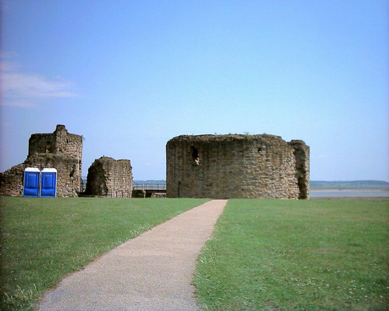


Detailed History
Flint Castle stands on a low rocky headland on the Welsh shore of the Dee estuary, in the town of Flint in Flintshire. The headland is an outcrop of sandstone and shale under glacial clay. By the thirteenth century it was joined to the mainland, though a tongue of alluvium between the rock and the later town suggests that it had once been a low island in the tide, rising only about four metres above the sea. The north-eastern quarter of the ground later taken for the town sits on that alluvium.
The rest was laid out on a gentle terrace of gravel and clay that climbs inland from about five metres to about fourteen metres above the sea. Before the eighteenth century changed the channels, a boat could cross to the English shore at high water, and a ford could be used at low water. Shotwick Castle stood on that English shore. The Dee’s tide here runs about ten metres at springs and about six metres at neaps, so a fortress on the rock could be supplied from the river or the sea and could watch the crossing into England.
Chester was a day’s march away.
The country around the headland was a border long before any English king planted a borough on it. The Welsh knew the north-coast territory between the later Llandudno and Hawarden as Perfeddwlad, the middle country. The cantref that included this shore was Tegeingl to the Welsh and Englefield to the English, a name that echoes the pre-Roman people called the Deceangli. Roman industry is real in the district, but it is not the origin of the planted town.
Lead-working debris at Pentre Ffwrndan was already remarked on in the eighteenth century, and digging since the 1840s has found furnaces, stone and timber buildings, and burials of a settlement active from the mid-80s to the middle of the third century. Stamped tiles of the Twentieth Legion, which had replaced the Second Legion at Chester in about 90, were found in a high-status complex opposite Pentre Farm, occupied from the earlier second century to the mid-third. A timber-revetted tidal channel east of the later settlement has been read as a place where processed lead left by water. Within the later streets of Flint itself the Roman finds are uncertain.
For almost eight centuries after the later Roman period, the immediate story of this headland is thin. What is clear is that the shore lay between Welsh and English power, with some settlement from the sea by Viking people, and that the ground chosen in 1277 was otherwise little inhabited. It lay in the ancient parish of Northop, Llaneurgain, and in the ancient district of Coleshill.
Edward I of England was born at the Palace of Westminster on the night of 17 to 18 June 1239, the eldest son of Henry III and Eleanor of Provence, and he died on 7 July 1307. Before he was king he was called the Lord Edward. In 1259 he briefly sided with the baronial reform movement and the Provisions of Oxford, then stayed loyal to his father through the Second Barons’ War. After the Battle of Lewes he was held hostage, escaped, and in 1265 defeated Simon de Montfort at the Battle of Evesham.
He left for the eastern Mediterranean in 1270. One account of the later fortress says he passed through Aigues-Mortes on the way to join the Eighth Crusade that year. The account of his own life says he left to join the Ninth Crusade, and that he was on the way home in 1272 when he learned that his father had died. He reached England in 1274 and was crowned at Westminster Abbey.
He was Lord of Ireland, and from 1254 to 1306 he ruled Gascony as Duke of Aquitaine under the French king. He stood about six feet two inches. His reign reformed administration and common law through inquiries into feudal liberties and through statutes on crime and property, and it made parliament a standing means of raising tax and changing the law. The same reign is also remembered for harsh dealing with Wales and Scotland, for a colonial manner of government in Ireland, and for the Edict of Expulsion of 1290, which removed the Jewish population from England.
As a young man he had held Perfeddwlad and had visited it, before Llywelyn ap Gruffudd took it in 1256.
Llywelyn ap Gruffudd, called Llywelyn the Last, was prince of Gwynedd from 1255 until his death. After campaigns across Wales in 1257 he proclaimed himself prince of Wales in 1258, and Henry III recognised him as such in the Treaty of Montgomery in 1267. His brother Dafydd ap Gruffudd moved between Welsh and English allegiance. Edward’s first Welsh war, in 1276 and 1277, was fought to recover lands the Crown and the marcher lords had lost.
The royal army came out of Chester and had a foothold on this headland by 21 July 1277. Rhuddlan was regained by the end of August. The war was closed in November. Under the treaty then made, Llywelyn continued to rule west of the Conwy, and the lands to the east returned to the English crown.
The inland parts of Perfeddwlad were given to Dafydd for his support in the war. The coastal parts, more useful for supply and trade, the king kept. Flint and Rhuddlan were the castles with which he meant to hold that coast.
Work at Flint began in 1277, at first under Richard L’Engenour, who later became mayor of Chester in 1304. Within a month of the army’s arrival the workforce is said to have swelled to nearly 2,300, among them experienced dykers from the Fens, and bonuses were paid to the barrowers who moved earth fastest, because the site had to be made defensible before winter. Another account says the castle and its earthworks were built by 18,000 labourers and masons. The two figures are left as they stand: a force of nearly 2,300 in the early weeks, and a total of 18,000 labourers and masons for the castle and the earthworks.
Temporary turf revetments and timber palisades were put up first and later replaced in stone. Most of the soldiers moved on within a month to the forward base at Rhuddlan, which took the main effort for the next two or three seasons. The pace at Flint then slackened, and the work went on intermittently.
The stone itself is described in more than one way. One account says the builders used local millstone grit ashlar and sandstone. Another says the brown, yellow and red stone was quarried on the site and across the Dee on the Wirral. A third says the local stone was unsuitable for the fine work, and that rafts brought stone from the Wirral to wharves cut for the purpose.
Timber, needed in quantity, came mostly from the woods inland and along the estuary toward Ewloe, and the felling also cleared ground that could later be farmed. Navigable channels were required both for defence and for those rafts. When the walls and towers were far enough on, carpenters, smiths and plumbers finished roofs, windows, doors, and a bridge between the castle and the town.
James of Saint George, in French Maître Jacques de Saint-Georges, was the Savoyard master of the works whom Edward came to rely on for the castles of north Wales. He was born about 1230. The evidence for his childhood is circumstantial, but it points to Saint-Prex, and to a father named John who was himself an architect-mason, identified with Jean Cotereel, the builder associated with Saint-Prex and Lausanne Cathedral. At Yverdon-les-Bains he worked for Peter II, Count of Savoy, at first with his father and, by 1265, alone, which is taken to mean that his father had died.
He then worked under Jean de Mézos, an engineer from Gascony who had worked for Henry III, at the château of Melphe at Salins-les-Thermes in 1267 and 1268. After Peter II died in 1268 he served Philip I, Count of Savoy, who preferred the Viennois to the castle of Chillon. Philip’s new palace-castle was at Saint-Georges-d’Espéranche, and the name James used in England refers to that place, or to the village of the same name, rather than to the saint of England. Between 1270 and 1275 he was responsible for Philip’s castles at Saint-Georges-d’Espéranche, La Côte-Saint-André, Voiron and Saint-Laurent-du-Pont, three of them round-towered and one an octagonal palace-castle.
His last known work in Savoy may have been at Châtel-Argent in the Aosta valley in the summer of 1275. There is then a gap until 1278, when he is first recorded in Britain. Edward had been at Saint-Georges-d’Espéranche on 25 June 1273, when Philip, the king’s great-uncle, did homage under a treaty of 1246. The king is thought to have met the master then, on the way back from crusade.
In April 1278 James was charged with ordering the castle works, the Latin phrase being ad ordinandum opera castorum ibidem. The first English record of the name Magistri Jacobi Di Sancto Georgio is dated 8 November 1280, two years after his arrival. That November he began to oversee Flint directly, because the building had been going too slowly, and he stayed for seventeen months before moving on to finish Rhuddlan. He is the man later credited with Conwy, Harlech and Caernarfon, all begun in 1283, and with Beaumaris on Anglesey, begun in 1295.
He died in 1309. One historian, Marc Morris, has called him one of the greatest architects of the European Middle Ages. Flint was already under way for three years before he stood on the site, but from 1278 he was the man charged with the design.
The plan he is credited with is unlike the later castles of the same king in north Wales, and it was not repeated in the British Isles. The inner ward is nearly square, about fifty metres east to west and about forty metres north to south, with round towers about eleven metres across at the south-west, north-west and north-east corners, each quarter-engaged in the curtain. At the south-east corner a great round tower, the donjon, about twenty metres across, stands detached in its own moat. It guarded the gateway and the drawbridge between the inner ward and the outer bailey, and it was a last refuge, with the rooms and stores a siege would need.
The walls of that tower are seven metres, twenty-three feet, thick at the base and five metres, sixteen feet, higher up. Entry was across a drawbridge into a central chamber on the first floor. There was at least one further storey. Small rooms were built into the thickness of the wall.
A vaulted passage runs round the inside at ground level, with steps down to a central chamber, arrow slits, latrine chutes, and a well on the south. Of five radial rooms on the first floor, the one facing east was a chapel, with a stoup and the springing of a barrel vault. The curtain of the inner ward rises from the bottom of an inner moat that is partly cut in the rock. A small square gatehouse held a drawbridge, reached by a fixed timber bridge part of the way across that moat.
The outer ward was divided from the town by a rock-cut outer moat, in places revetted in stone, more than three hundred and fifty metres long. Acorn barnacles on the sides of that outer moat show that it was dug open to the tide. Excavation has also suggested that part of the outer moat south of the great tower was used as a wharf, and a further gap in the town banks has been read as a second wharf, roughly where the playground and car park at the east end of Castle Dyke Street now lie.
The design is explained by more than one model. It is called a Savoyard plan in which one corner tower is enlarged and isolated, serving as both corner tower and keep, as at Dourdan. The great tower has been compared with the Tour de Constance at Aigues-Mortes. It has also been described as a classic carré savoyard, close to the castle at Yverdon by Lake Neuchâtel: the same shape and the same use of a corner tower as the donjon, with ground dimensions a third larger.
An influence from Jean Mésot, or Jean de Mézos, who had worked in southern France before he worked with James in Savoy, is offered as another route for that idea. In the 1280s or 1290s Richard of Chester, one of the military engineers at Flint in 1277, laid out the moated garden at Belgrave Moat at Eccleston near Chester as a smaller copy of the inner ward and its detached keep. The men who built Flint were proud enough of the plan to repeat it at home.
When spending on the first campaign stopped in 1284, the inner ward, the outer bailey, and a plantation town beyond the outer bailey were in being, separated by the tidal moat and joined by a gatehouse and a drawbridge. The recorded outlay for fortress and town was six thousand and sixty-eight pounds, seven shillings and five pence. A comparison of average earnings has set that sum, taken as £6,068 in 1307, beside £6.6 million in 2008. The work did not then end for good.
It continued, on and off, for about twenty years. The last large addition, in 1301 to 1303, across the end of Edward’s reign and the start of his son’s, was a timber upper storey on the great tower, described as noble and beautiful. A timber gallery on top of the keep is also recorded for the visit, in 1301, of Edward, prince of Wales. In that same year the town and castle were granted to Edward of Caernarfon, the future king Edward II, as part of his earldom of Chester.
The town was the most symmetrical of the new towns of medieval Britain, and it is often used to show what a castle-town was meant to be. The site was level and almost empty, so the plan could be drawn clean. Survey has found a line that bisects the town and passes through the great tower, the medieval market hall, and the church: crown, borough, and church on one axis. The church was dedicated to St Mary and remained for centuries a dependent chapel of Northop, on the ground where its successor stands.
The town hall stood by the marketplace. John Speed drew the place in a field sketch of 1607, kept at Merton College, Oxford, and published it with his map of Flintshire in the Theatre of the Empire of Great Britaine in 1610 and 1611, and again as a small cartouche on his map of Wales. Those drawings show the coast road, the line of the modern Holywell Road and Chester Street, crossed at right angles by four parallel streets, two on each side of the axis through the great tower. The street that is now Church Street was aligned on the gatehouses of the outer and inner wards at one end and on the road south of the town at the other.
Anyone coming to the castle came through the town, which was a further defence. Lanes just inside the inner bank and just outside the outer bank may lie on top of the medieval banks and so be later. The streets appear to have been set out in the rods, chains and furlongs then in use.
The name came with the rock. It is first written le Flynt or le Flynd, from the English word flint, a hard stone. Late in the year of the conquest it is also written le Cayllou or le Chaylou, from the French caillou, a pebble. Beaumaris, another of Edward’s new towns, kept a French name.
Flint did not. By early 1278 a weekly market and an annual fair had been proclaimed, and agents were renting plots, even though the defences were not finished. The first royal charter, in 1284, gave the borough its privileges and its rights in land. A second charter that year gave timber and pasture in the woods of Northop, Leadbrook, Kelsterton, Wepre and Soughton.
The charter diswarrened and deforested the lands assigned to the borough. In line with other new boroughs of this time, people of Jewish descent were forbidden to live there. From 1284 until 1935 the constable of the castle was, by that office, mayor of Flint. The constable lived in the great tower until that lodging was destroyed.
Gerard de St Laurent held the castle from 1278 to 1281. William de Perton is named in 1282. Reginald de Grey, from 1284, is counted the first mayor. He is not the later Reginald de Grey who quarrelled with Owain Glyndŵr.
Take-up was slow. In 1282 agents were told they might let plots free for ten years and at a lower rent after that. Each free plot was offered with forty acres. A list from the 1290s names seventy to eighty householders.
All but five appear to be English incomers, and at least a quarter can be tied to the king’s works at Flint or elsewhere. The occupations include a clerk, tailors, tanners, a butcher, a cobbler, masons, a harrower, carpenters and sawyers, blacksmiths, a plasterer, a driver, a merchant in iron and steel, a miner, a lead-worker, millers, a lime-burner, a glazier and a salt-maker. The women of the town are not in the list. The men came, sometimes with brothers, from Cheshire, Merseyside, Staffordshire, Hertfordshire, Bedfordshire, Hereford and London, and from Coleshill nearby.
Friction with the Welsh people already living in the district did not stop. Speed’s map of 1610 still shows many empty plots. Whether they were never built, or were built and later abandoned, is not settled. Until the seventeenth or early eighteenth century most houses, the church perhaps aside, are thought to have been timber-framed, with wattle and daub and roofs of thatch or reed.
The town banks were of a form shared with Rhuddlan, the two places having been started within weeks of each other. Flint’s circuit was a rectangle with rounded corners, double banks and a great ditch, about 225 by 420 metres, some 9.5 hectares, against about 10 hectares at Rhuddlan. The only explicit payments for the town ditch fall in 1281 to 1283 and 1284 to 1286, so the circuit was not all built in the first season. Some of that digging is described as after the war, and may be repair.
A section dug in a hurry at Duke Walk and Swan Walk, toward the south-west end of Duke Street, before redevelopment in the early 1970s, found a ditch about sixteen metres wide and three metres deep. The outer bank had gone. The inner bank survived to about three-quarters of a metre and had been about seventeen metres wide at the base, with a steep outer face revetted in turf. A timber palisade on the crest is the likely defence against arrows.
The whole belt of bank and ditch was about thirty to forty metres deep. It is not yet known whether the ditch ran across the three entrances, to be crossed by bridges, or whether the gates were simple or were timber gatehouses, as seems to be the case at Rhuddlan. The absence of ploughsoil under that bank fits the idea that the town was set out on ground that had not been long in cultivation. In 2015, as a block of flats of the 1960s came down on Coleshill Street, archaeologists opened a further stretch of the thirteenth-century bank and ditch, a mound about thirteen feet, four metres, high.
Iestyn Jones described Flint as an implanted bastide, built with the castle, and said the earthwork was there to protect people who had come from all over England. Kate Pitt, directing the digging, said the ditch was cut steeply, as a defence should be, and that the lower fills were a red sandy silt clay, which may mean the ditch held tidal water, as the castle moat did. The same trenches produced pottery of the seventeenth century, perhaps from serving dishes, and a tobacco pipe of about 1850. The team expected to remain on the site until the end of August 2015, in the hope of reaching deposits of the 1200s.
Historians had long expected such a dyke: Speed’s map of 1610 draws a double bank around the town from the south and the west. The trench was to be covered again when a health centre was built on the ground.
The open fields were part of the same foundation. The borough ran to what became the parish of Flint together with the township of Coleshill Fawr in Holywell parish, out to Oakenholt on the east, Flint Mountain on the south, and Gadlys on the west. A large part of that land was cleared of timber and laid out as open field in the later thirteenth century. The tithe map of 1839 still shows a grid of long fields running up and down the slope, distinct from the irregular fields beyond them.
About 440 hectares, 1,090 acres, of former open field can be picked out. At forty acres to a householder, that is land for up to about thirty farming families. There is no sign that the strips were reallotted by lot each year, as in many English villages. They were more likely rented from the borough from the start.
Two open fields are suggested, one south and east in the township of Flint, one west and south-west in Coleshill Fawr. Field names on the tithe include Maes y dre, the town field, and others with maes, acre, or quillet. A coastal group was called Safurlum, perhaps sea furlong. The strips were about a furlong long, 220 yards or 201 metres, and often only a rod wide, about sixteen and a half feet or five metres, divided by unploughed baulks.
A charter of Edward III in the 1360s still describes part of the borough boundary by selions and headlands in Leadbrook. Ridge and furrow, and the reversed-S curve of fields ploughed by a long team, survive in places. The land either side of the Swinchiard Brook, the name containing the English word for swine, seems to have stayed common. Flint Marsh and the salt marshes gave further grazing before enclosure and reclamation from the early eighteenth century.
A watermill at Atiscros, Adescrossmulne, is recorded in 1358. Goods moved by water from the start: a cargo of fresh bread from Chester was lost at sea in 1283, and 140 tons of lead went by sea to Conwy in 1286.
The war that changed the purpose of the castle began in 1282. One account says that on Palm Sunday that year Dafydd ap Gruffudd attacked Flint itself, and that the attack drew his brother Llywelyn into the revolt that ended with Llywelyn’s death. Another account says the revolt opened on Palm Sunday with an attack on Hawarden Castle by Dafydd and Llywelyn together. Both agree that Edward then decided to end Welsh independence, and that over the next years the weight of building and government moved west, to Conwy, Caernarfon, Harlech and Beaumaris.
Flint and Rhuddlan lost the military importance they had been given in 1277, and they were not given the stone town walls later built around the boroughs of Gwynedd. The town at Flint was burned in that war, and the castle was besieged by Welsh forces. The building was not finished when that happened. Payments after the war may include repairs.
For the fighting of 1282 and 1283 at Flint itself, no deaths are recorded in the local account, only two accusations of theft and the burning of a number of houses. Llywelyn ap Gruffudd was killed in an ambush at Cilmeri on 11 December 1282. Dafydd ap Gruffudd was prince after him until he was captured on 22 June 1283. On 3 October 1283, on Edward’s orders, he was hanged, drawn and quartered.
He was the last native prince of Wales before the conquest was complete. In March 1284 Flint became the county town of the new shire of Flint. The wider royal land was organised under the Statute of Rhuddlan into shire counties and brought into the new principality of Wales. The conquest of 1277 and of 1282 to 1283 left most of the taken territory as a royal fief, later the usual endowment of the heir to the English throne, and the rest as new marcher lordships.
Welsh independence, as a political fact, ended then, though the country was not folded into the kingdom of England by statute until the Laws in Wales Acts of 1535 to 1542.
In September 1294, ten years after the first charter, the town was nearly destroyed again. Madog ap Llywelyn, of a junior branch of the house of Aberffraw and a distant kinsman of Llywelyn, led the revolt of 1294 and 1295, the longest Welsh rising until Owain Glyndŵr. In a land grant he used the title prince of Wales. He lived on after 1305.
One account of Flint says that in 1294 the constable was forced to set fire to the fortress so that it would not be captured, and that the castle was later repaired and partly rebuilt. Another account says that in September 1294 the constable ordered the town set on fire, to keep the Welsh from using it in a siege of the castle, and that seventy-three or more buildings were destroyed, perhaps every house, though the church may have been spared and some goods stored there. The townspeople were compensated. The claims include a tanner’s stock in trade, and a great deal of farm produce: corn, hay, cows, oxen, horses, sheep, chickens and pigs.
The houses were rebuilt. The rising was put down hard, and the limits on Welsh people in and around the borough were drawn tighter. The constable list names Reginald de Grey from 1290 to 1295 and Sir Edward de Laye in 1294. The fire accounts speak only of the constable, and do not say which of those men gave the order.
Ill feeling between the communities lasted well into the fourteenth century. In 1350 Edward III did grant the constableship and the shrievalty to two Welshmen, but only if an Englishman remained under-constable, because, in the words then used, the king would that the same castle be kept by none other than an Englishman.
Through the fourteenth and fifteenth centuries the castle was kept up because it was the financial and administrative centre of the county, and because it was a halt on the way by land and sea to Ireland, where the king had wide estates. Repair appears in the royal accounts for 1328 to 1352 and again for 1422 to 1437. In 1382 and 1383 a new hall was built inside the castle, a hall of Flint in which the king’s justices might hear pleas. In 1452 a new hall and chamber were built.
The inner moat was probably beginning to dry by the end of the fourteenth century. By the fifteenth century the outer moat no longer took the tide, and the excavations show that silting had become serious. The plagues of 1349 and of the later fourteenth century shrank the workforce here as elsewhere, and the open-field strips began to be gathered into fewer hands, with more Welsh names among the fields than in many parishes of eastern Flintshire. In the late thirteenth century Flint had been the most prosperous town in the shire.
Over the next two or three centuries that prosperity faded.
Edward II was born on 25 April 1284, the fourth son of Edward I and Eleanor of Castile, and he was known as Edward of Caernarfon. He became heir when his elder brother Alphonso died, was knighted at Westminster Abbey in 1306, and became king in 1307 on his father’s death. The timber gallery of 1301 was for him as prince. In 1311 he and Piers Gaveston, who had been in his household since 1300, met at this castle.
The nature of their bond is disputed: friends, lovers, or sworn brothers. Gaveston’s power angered the barons and the French royal family. The Ordinances of 1311, which Edward was pressed into accepting, banished Gaveston. Edward revoked them and recalled him.
In 1312 Thomas, Earl of Lancaster, and other barons seized Gaveston and had him killed. In 1314 Robert the Bruce defeated Edward at Bannockburn. Famine followed. Later the Despensers, especially Hugh Despenser the Younger, held the king’s confidence until Lancaster forced their exile in 1321.
Edward destroyed Lancaster in a short campaign, ruled with the Despensers by executions and confiscations, and at last made a truce with Robert in Scotland. In 1325 Isabella, his queen and the daughter of Philip IV of France, was sent to negotiate in France, refused to return, and in 1326 invaded with Roger Mortimer. Edward was captured in Wales in November, gave up the crown in January 1327 to his son Edward III, and died at Berkeley Castle on 21 September 1327, probably murdered on the orders of the new regime. The 1311 meeting at Flint sits inside that longer failure.
The next king to be unmade in connection with this castle was Richard II, born at Bordeaux on 6 January 1367, son of Edward the Black Prince and Joan of Kent. He became king in 1377 at the age of ten, when his grandfather Edward III died, the Black Prince having died in 1376. His early government was in the hands of councils shaped by his uncles John of Gaunt and Thomas of Woodstock. He faced the Hundred Years’ War and, in 1381, the Peasants’ Revolt, which he had a central part in suppressing.
He was less drawn to war than his father or grandfather, he guarded the royal prerogative, and he kept a private retinue rather than depending on the great nobles. In 1387 the Lords Appellant took control. By 1389 he had it back, and for eight years he governed more quietly. In 1397 he struck at the Appellants.
The two years after that have been called his tyranny. When John of Gaunt died in 1399, Richard blocked the inheritance of Gaunt’s son Henry Bolingbroke, whom he had already exiled. Henry landed in June 1399. The force he brought was small and grew quickly.
Henry Hotspur Percy was among the men who made that landing into a change of king. Sir Henry Percy was born on 20 May 1364 at Alnwick Castle, eldest son of Henry Percy, first Earl of Northumberland, and Margaret Neville. The Scots called him Hotspur, Haatspore, for the speed of his advances on the border. Edward III knighted him in April 1377 together with the future Richard II and the future Henry IV.
He was warden of the east march, fought in Scotland, France and at sea, and in 1388 was a Knight of the Garter. At Otterburn on 10 August 1388 he was captured and ransomed for 7,000 marks. He served in Ireland and as lieutenant of Aquitaine for John of Gaunt. In the summer of 1399 he and his father joined Bolingbroke at Doncaster and marched south.
He was one of the earliest and principal movers of Richard’s removal. After the deposition he was richly rewarded. He was high sheriff of Flintshire in 1399, and the list of constables names Henry Hotspur Percy at this castle from 1399 to 1403. In north Wales the rising of Owain Glyndŵr pressed him.
In March 1402 Henry IV made him royal lieutenant there. On 14 September 1402 he, his father, and the Earl of Dunbar defeated a Scottish army at Homildon Hill and captured Archibald Douglas. He then turned against Henry IV, over unpaid wages on the Scottish border, the king’s favour to Dunbar, a demand that the Percys hand over their Scottish prisoners, the failure to settle with Glyndŵr by negotiation, and the growing military role of the king’s son in Wales. He was killed at the Battle of Shrewsbury on 21 July 1403.
At Flint itself, in August 1399, Richard passed into Henry’s hands. One account says Richard was held here by Henry Bolingbroke and then taken back to London. Another says he surrendered here to Henry IV, the name Henry took as king. The man was the same.
A further account says that in August 1399 Richard surrendered to Henry Bolingbroke, soon to be Henry IV, on condition that his life be spared after he gave up the crown. The meeting at the castle is dated by one account to 19 August 1399, and the surrender by another to 20 August, the forty-sixth or forty-seventh day after Henry entered England. Richard had come from Ireland. One telling of the journey says that in mid-August he left Conwy with a small company, was ambushed at Penmaenhead east of Colwyn Bay, and was escorted to Flint, where Bolingbroke arrived with his army and took him on to Chester.
A chronicle of the day says that after a short conversation they rode to Chester Castle that night, that Richard asked that low-born men not be let in to crowd him, and that Henry granted it and treated him with respect on the road. Richard’s household, his horses and his goods fell to Henry. His own followers were robbed by Welshmen and Northumbrians. He was kept in the Tower of London until a parliament met.
On 29 September 1399 he gave up the crown. Henry was crowned on the feast of Saint Edward the Confessor, dated in one account to 13 October 1399. He was the first king of the house of Lancaster, and the first English ruler since the Norman Conquest whose mother tongue was English. Richard is thought to have died in captivity about 14 February 1400, starvation among the explanations, though the manner of his death is still questioned.
He had been moved to Pontefract before Christmas. The meeting at Flint was later set on the stage in the play about his reign. Henry IV, born about April 1367 at Bolingbroke Castle and dead on 20 March 1413, spent his reign facing rebellions, above all those of Glyndŵr and of Hotspur. His seizure of the crown fed the later dynastic quarrel of the Wars of the Roses, from 1455 to 1487.
His eldest son, Henry of Monmouth, took on the government in 1410 as the king’s health failed, and succeeded as Henry V.
Owain Glyndŵr, Owain ap Gruffudd Fychan, was born about 1359 and died in hiding about 1416. He was lord of Glyndyfrdwy. A dispute with his English neighbour, a later Reginald de Grey, not the constable of 1284, opened onto a national revolt. His supporters acclaimed him prince of Wales on 16 September 1400.
Flint was one of the English towns of north-east Wales attacked by his supporters in September 1400. In early August 1403 his forces laid siege to the castles of Flint, Rhuddlan and Hawarden. The castle was still strong enough to shelter the townspeople, who were said not to dare linger outside it. The town itself was not destroyed.
A mill at Flint was, and the town fields were said to lie uncultivated. No rents were collected in 1407 or 1409, because of the damage and the poverty of the burgesses. The mill was rebuilt in 1412. Between 1404 and 1405 the rising held a great part of Wales.
In 1404 Owain held a parliament at Machynlleth, with envoys from France, Scotland, Castile and Leon, and from every region of Wales. The Pennal letter of 1406 speaks of two universities, a return to the laws of Hywel Dda, and a wider border. French, Breton and Scottish help came. By 1409 Harlech and Aberystwyth, the last rebel castles, were taken.
Owain refused two pardons, left the record in 1412, and was never captured. Penal laws against the Welsh, passed in answer to the rising, deepened the anger that had fed it. At Flint the castle’s ditches, hard to maintain without a large labour force, continued to silt.
A poem by Ieuan ap Tudur Penllyn, of about 1480, laughs at an English wedding feast in the town and at an English bagpipe player, and in doing so shows that the old friction was still understood. He calls the place a double-walled town and lop-sided, mocks the company as dealers in barley and wheat, and says the town may keep its furnace. Speed’s field drawing of 1607 shows about a hundred buildings inside the defences, the town hall and the church among them, and about fifteen more just outside, mostly near the three main gates. A market cross stood in the central square.
Stocks and a gallows stood to the north-west, probably near the later shoreline of the Castle Park industrial ground. The Sessions House on Church Street was probably first built early in the seventeenth century. The medieval church of St Mary stood until a new church replaced it on the same spot in the middle of the nineteenth century. A description of the houses says they were thatched, with stone walls so decayed that in many places they were ready to fall.
About half the building ground inside the banks was still field, garden and orchard. In the early 1650s John Taylor wrote that war had made the place miserable, that the castle was almost buried in its own ruins, and that the town was so spoiled that within memory it had no market, and no saddler, tailor, weaver, brewer, baker, botcher or button-maker, nor so much as the sign of an alehouse.
That ruin was the work of the English Civil War. The English Civil War, also called the Great Rebellion, was the series of wars and political struggles between Royalists and Parliamentarians in the kingdom of England from 1642 to 1651, inside the wider Wars of the Three Kingdoms from 1639 to 1653. Wales, already annexed to the kingdom of England, was drawn into the same crisis. The First English Civil War was fought over the balance of power between parliament and Charles I, and it ended in June 1646 with the Royalists beaten and the king in custody.
Most of those who had gone to war in 1642 had wanted parliament to share in government, not to abolish the monarchy. Charles’s refusal to concede produced a stalemate, and fear of radicals in the New Model Army, Oliver Cromwell among them, helped push moderate parliamentarians toward a temporary understanding with Royalists and with the Covenanter Scots. Defeat in the Second English Civil War of 1648 led to the execution of Charles I in January 1649 and to the Commonwealth. In 1650 Charles II was crowned king of Scotland in return for promising a Presbyterian church in England and Scotland.
The war that followed ended at Worcester on 3 September 1651. Ireland and Scotland were brought into the Commonwealth. The arrangement did not last, and the Stuart Restoration came in 1660. The nicknames Cavalier and Roundhead, for Royalist and Parliamentarian, began as insults.
From the Restoration into the nineteenth century people more often said the rebellion or the great rebellion. Some historians have preferred to speak of an English revolution, and some of the British civil wars.
Flint was garrisoned for the king in 1642 and was used as a base for harrying Chester. During the war it passed more than once between Royalist and Parliamentarian hands. One account says it surrendered to parliament in 1646. Another says the Parliamentarians took it in 1647 after a siege of three months.
It was then demolished so that it could not be used again. One account says the demolition was ordered by parliament, and groups it with the slighting of Rhuddlan and of Raglan. Another says it was slighted under a destruction order associated with Oliver Cromwell, and that the ruins visible now are what that order, and later robbing of stone for the town, left behind. By 1652 the castle was almost buried in its own ruins.
Oliver Cromwell was born at Huntingdon on 25 April 1599 and died on 3 September 1658. He was a member of parliament for Huntingdon in 1628 and for Cambridge in 1640, a commander of Parliamentarian cavalry, and from 1645 commander of the cavalry of the New Model Army under Thomas Fairfax. He pressed for the execution of Charles I, conquered Ireland in 1649 with a brutality that is still condemned, and was Lord Protector from December 1653 until his death. His son Richard succeeded him and could not hold the place.
After the Restoration, Cromwell’s body was taken from Westminster Abbey and hanged at Tyburn on 30 January 1661. His head was cut off and shown on Westminster Hall until at least 1684, and was reburied in 1960. Nothing in the record of Flint says that he came to the castle in person. The destruction order is the link that one account draws between his authority and these walls.
The office of constable survived the ruin. Thomas Edwards held it until 1664, Ralph Whitley after him, and a long line of local gentlemen after that, down to the twentieth century.
Eighteenth-century visitors found a small town. Daniel Defoe thought it so small that, having no market, it was little more than a village with the trappings of a shire town. Thomas Pennant, who knew the district, said it was laid out with great regularity but that the streets were far from complete, and the regularity led him to guess, wrongly, at a Roman station, on the analogy of Chester. Henry Wyndham thought the town scarcely worth a traveller’s time.
Between the 1780s and the 1840s it had a short life as a bathing place. A guide of 1800 says it had been much frequented in the bathing season. Samuel Lewis, in 1833, called the buildings inferior to the regularity of the streets, but noted hot baths for visitors. Those baths stood at The Bardyn, just south-east of the castle.
Edward Parry, in 1843, called the sail from Chester pleasant and the lodgings cheap. Industry ended that fashion. A traveller in 1833 called Flint a nauseous town of old houses and chemical fumes. In 1879 the Chester paper said that even at the best of times it was wrapped in sulphurous smoke.
The railway arrived in 1848 and cut through the middle of the medieval plan. The town council had asked for a viaduct and was refused. It was promised a first-class station instead. The line, and the walls beside it, severed the castle and the north-eastern streets from the rest of the town.
Corporation Street was the new road the borough obtained alongside the tracks. An ironworks grew up against the castle, partly covering the moat and touching the walls. It has gone. A quarry worked nearby.
Part of the outer bailey was occupied by the county gaol of the later eighteenth century, since demolished, and in the nineteenth century part of that bailey was in use as Flintshire’s county jail.
J. M. W. Turner painted a watercolour of the castle in 1838, when the ruin stood above an estuary already turning industrial.
Joseph Mallord William Turner was born on 23 April 1775 in Maiden Lane, Covent Garden, and died on 19 December 1851. He began as an architectural draughtsman and a painter in watercolour, entered the Royal Academy Schools at fourteen, and was a Royal Academician by the age of twenty-seven. He made about 550 oil paintings and more than 2,000 watercolours. His later landscapes grew more abstract than the taste of his own day liked.
At his death his estate was valued at £140,000, and he left the nation about a hundred finished oils and about two hundred unfinished ones. The 1838 sheet is the record he made of this particular ruin, seen across the light of the Dee.
Industry, not visitors, made the modern town. A lead smelter by the Swinchiard Brook in 1699 stands at the start of a sequence that became an alkali and bleach works, known as Castle Works, on the ground of the present Castle Park industrial estate. Courtaulds took the former German textile factory at Aber in 1917, opened a new Castle Works in 1920 on the alkali site west of the castle, and in 1927 took Deeside Mill. At its height the firm employed many thousands, in one account about 10,000, and was the main employer.
Aber Works closed in the late 1950s, Castle Works in the 1970s, and Deeside Works in the 1980s. The town’s population rose from just over a thousand in 1801 to just under five thousand in 1891, still largely inside and just outside the medieval banks, in workers’ cottages that the twentieth century cleared. The first expansion beyond those banks came in the decade before 1914. The railway, the chemical works and the clearance of tower blocks have broken the grid, but Church Street, Sydney Street and much of Feathers Street still follow three of the medieval streets, and the line of the banks can be walked in Chapel Street, Coleshill Street, Earl Street, Evans Street, Castle Street and Duke Street.
Mumforth Street was lost to mid-twentieth-century housing.
The castle itself was excavated to help conserve and display it. Between 1971 and 1974 the inner moat was sectioned and the outer ward was opened. Roads, a gatehouse and a rock causeway were found, and the profile of the Edwardian town defences was examined, together with pottery, tile, stone and wood. The great tower still shows the vaulted passage and the well.
Much of the curtain other than the south wall and the north-west corner is modern work on the medieval line. Arrow slits remain, some of them degraded. The ashlar cladding survives in patches. In 2017 a spiral stair was put into the north-east tower, with a platform looking over the estuary.
The same year a proposal for a giant iron ring in the castle grounds was dropped. The architects said the ring stood for the unstable nature of the crown. Critics heard it as a monument to the subjugation of the Welsh, and the scheme was set aside as divisive. In June 2019 a watching brief was kept on ground investigations for a proposed visitor centre.
Since 2024 the intention has been to use the Welsh name, Castell y Fflint, even when writing English. As of 2026 that change had not been carried through on the public name of the monument. Access to the ruins is free, along a path. The isolated keep and most of the rest of the castle can be walked.
The building was designated on 11 September 1995 and is protected both as a listed building of the highest grade and as a scheduled ancient monument. A ship of the Royal Navy, launched in 1943, carried the castle’s name, but that is a namesake, not a part of the fabric.
The last constable whose life is fully recorded in connection with the office is Albert Gladstone. Sir Albert Charles Gladstone, fifth baronet, was born on 28 October 1886 at Hawarden Castle in Flintshire, eldest son of the Reverend Stephen Edward Gladstone and Annie Crosthwaite Wilson, and grandson of William Ewart Gladstone. At twelve he attended his grandfather’s state funeral. He was educated at Eton and at Christ Church, Oxford, and took his bachelor’s degree in 1909.
He rowed in the Boat Race four times between 1906 and 1909, won the Grand Challenge Cup at Henley in the Christ Church eight in 1908, and four weeks later was in the Leander eight that took the gold medal for Britain at the 1908 Olympic Games. In the war of 1914 to 1918 he served in Mesopotamia and at Gallipoli, was mentioned in dispatches, rose to captain in the 2nd/5th Royal Gurkha Rifles in the Indian Army Reserve, and was made a Member of the Order of the British Empire in 1919. He was a director of the Bank of England from 1924 to 1947, a senior partner in the East India house of Ogilvy, Gillanders and Company, Lieutenant of the City of London, and High Sheriff of the County of London in 1929. In 1935 he became constable of Flint Castle and held the post until he died.
That was the year the old rule, by which the constable was mayor, came to an end. Henry Gladstone, first Baron Gladstone of Hawarden, had held the constableship in 1934 and 1935, immediately before him. Albert succeeded his cousin Sir John Evelyn Gladstone as baronet on 12 February 1945. He died at Fordingbridge in Hampshire on 2 March 1967, aged eighty, unmarried and without children, and the baronetcy passed to his brother Charles Andrew Gladstone.
The constable’s lodging in the donjon had been gone for centuries. The office he held was a title over a ruin that had already been a public antiquity for a long time, and that is how the castle stands now: a thirteenth-century inner ward and a detached great tower on the Dee, with the town’s medieval streets still readable behind the railway, and with the earth of the town ditch still turning up under modern buildings when they are taken down.
Sources
- Flint Castle — Wikipedia
- Edward I of England — Wikipedia
- James of Saint George — Wikipedia
- English Civil War — Wikipedia
- Albert Gladstone — Wikipedia
- Edward II — Wikipedia
- Henry Hotspur Percy — Wikipedia
- J. M. W. Turner — Wikipedia
- Oliver Cromwell — Wikipedia
- Llywelyn ap Gruffudd — Wikipedia
- Dafydd ap Gruffudd — Wikipedia
- Madog ap Llywelyn — Wikipedia
- Richard II of England — Wikipedia
- Henry IV of England — Wikipedia
- Owain Glyndŵr — Wikipedia
- Conquest of Wales by Edward I — Wikipedia
- Flint Castle — Cadw
- Flint: Understanding Urban Character — Cadw
- Flint Castle including revetment wall of ditch — Cadw
- Your Community: Flint — Clwyd-Powys Archaeological Trust
- Flint Castle — Coflein
- Flint; Fflint — Coflein
- Historic Flint Castle defences found under block of flats — BBC
- Flint archaeological dig unearths 800 year old town defences — North Wales Live
- Flint: excavations at the castle and on the town defences 1971–1974 — Archaeology Data Service
- Richard II meets a sticky end near Colwyn Bay — Colwyn Bay Heritage Group
- Abdication of Richard II — All About History
- YFflintLB04.JPG — Wikimedia Commons
- Benkid77 Flint Castle 290609.JPG — Wikimedia Commons
- Fflint Castle - geograph.org.uk - 99047.jpg — Wikimedia Commons
- Fflint Castle - geograph.org.uk - 101885.jpg — Wikimedia Commons
- Flint Castle - geograph.org.uk - 1286916.jpg — Wikimedia Commons
- Flint Castle - geograph.org.uk - 1584407.jpg — Wikimedia Commons
- Flint Castle - geograph.org.uk - 1587131.jpg — Wikimedia Commons
- Castell Fflint (1130957).jpg — Wikimedia Commons
- Castell y Fflint.jpg — Wikimedia Commons
- Flint Castle - geograph.org.uk - 1808170.jpg — Wikimedia Commons