
Settlement · Fortification
Dinas Emrys
Iron Age hillfort and castle probably erected by Prince Llewelyn II to guard the road to the mountain pass of Snowdon

Gwynedd, United Kingdom · United Kingdom
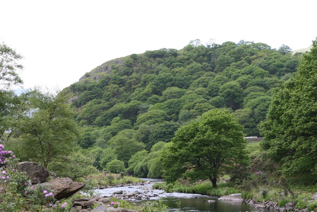
- Dinas Emrys, the stronghold of Emrys, is a rocky hillock near Beddgelert, about 70 or 76 metres above the Glaslyn, looking over the south end of Llyn Dinas.
- Ruinous ramparts, a pool, and the base of a rectangular tower remain, and the dates run, in different accounts, from a possible pre-Roman palisade to a medieval keep.
- The Historia Brittonum places Vortigern’s falling tower here, and the boy who reveals two dragons in the pool is Ambrosius, later called Merlin Ambrosius.
- Excavation in 1910 and from 1954 to 1956 found Roman pottery, a chi-rho stamp, and a platform over the pool dated later than either Vortigern or Ambrosius.
- The tower is called an eleventh-century work, a twelfth-century keep, a building of Llywelyn ab Iorwerth’s reign, and a castle some people assign to Llewelyn the Last.
Visiting
Dogs are allowed to enter the site on leads.
History
Dinas Emrys is a rocky wooded hillock near Beddgelert, above the Glaslyn at the south end of Nant Gwynant, looking over the southern end of Llyn Dinas. The rise above the valley is given as about 76 metres, or 250 feet, and also as some 70 metres. The tower base stands at 135 metres above ordnance datum, and the hill lies about 2 kilometres north-east of the village.
A ruinous wall circles the top, with outer works on the west, a rectangular tower on the summit, and a pool on the south. The enclosed area is given as about 10,000 square metres and as about 1.2 hectares. The walls are described as once 2.5 to 3 metres thick, and what survives is often a low grass-covered bank. There is no ditch.
The western approach is a steep zigzag route through more than one entrance, with a crag between the lines. A north-eastern entrance is called a later addition, and an oval structure there may instead have blocked an older way in. A sheepfold by the pool is called modern in one account and nineteenth-century in another.
The older name was Dinas Ffaraon, or Dinas Ffaraon Dandde. The tale of Lludd and Llefelys buries two dragons there. The Historia Brittonum, of about 829, sets Vortigern’s falling tower on this hill, and the boy who explains the pool is later called Merlin Ambrosius.
Ambrosius Aurelianus is the general named by Gildas, and he may or may not be the boy at the pool. Geoffrey of Monmouth separates them, sets the child at Carmarthen, and makes Aurelius a brother of Uther. King Arthur is not placed on this hill by the accounts of his legend.
Digging in 1910 and from 1954 to 1956 found Roman and later occupation, imported pottery, a chi-rho stamp, and a platform over the pool dated later than Vortigern or Ambrosius. A radiocarbon result from the pool silts falls between 1265 and 1410, and another, from a deep post-hole, is 650 plus or minus 100 years. Iron Age use is argued from the sequence and is not fixed by a dateable find.
The tower is called eleventh-century, twelfth-century, a work of the reign of Llywelyn ab Iorwerth, who died in 1240, and, by some, a castle of Llewelyn the Last, who died in 1282. Those dates exclude one another. No building account names either prince as the founder.
Thomas Pennant’s tour of 1778 includes a view of the hill, and Joseph Mallord William Turner drew Snowdon and Dinas Emrys from above Beddgelert. The hill is a scheduled monument on land held by the National Trust, and the tower masonry was consolidated in 2013. The records read for the hill do not describe a world-heritage inscription.
Images


Detailed History
Dinas Emrys, a name that means the city or stronghold of Emrys, is a rocky and wooded hillock near Beddgelert in Gwynedd. It stands at the southern end of Nant Gwynant, above the Glaslyn, and looks over the southern end of Llyn Dinas. One account places the summit about 76 metres, or 250 feet, above the valley floor. The historic environment record puts the same rise at some 70 metres.
The base of the tower on the crest is recorded at 135 metres above ordnance datum, which is a height above the sea rather than a height above the river. The hill is about 2 kilometres north-east of Beddgelert. The community is Beddgelert, the historic county Caernarfonshire, and the record places the fort inside what that record still calls Snowdonia National Park. A grid printed with the open account of the hill is SH 60669 49228.
The scheduling coordinates fall at easting 260653 and northing 349231.
What a visitor sees is not one castle of one century. A ruinous wall encircles the top. Outer works stand at the west. The foundations of a rectangular stone tower occupy the summit.
Slight remains survive beside a pool. The dating is not treated as settled. Late prehistoric, Roman, sub-Roman and medieval periods are all said to be represented. Another summary stretches the possible activity from the Iron Age to the post-medieval period.
The enclosed ground is given as about 10,000 square metres in one description of the walls, and as approximately 1.2 hectares in the environment record and in a hillfort atlas. That atlas also measures the fort at about 200 metres east to west by 100 metres, and calls the interior 1.2 hectares, so the plan is not a simple rectangle. There are no ditches. Where the natural slopes were enough, walls are absent or reduced to the thickness of an ordinary field boundary.
The walls that still show are a poor match for the walls as they were built. A published description of the fortifications speaks of stone walls between 2.5 and 3 metres thick, 8 to 10 feet, using every irregularity of the rocky top and enclosing an irregular area. The environment record says the ramparts appear to have been about 10 feet thick, of rubble faced with laid stone, and elsewhere that the stone-faced rampart was up to 3 metres thick. The scheduling text, describing what survives rather than what was first built, calls the encircling wall a grass-covered stone bank between 1.0 and 2.5 metres wide and 0.5 metres high.
At the western entrance that wall is 3 metres wide and 1.2 metres high. A survey of the ground in the early twenty-first century found the first western rampart about 2 metres wide, standing at most 1 metre high in the entrance, with enough fallen stone to show that it had once been massive. The next rampart up the hill preserved, in places, the shape of a wall 1.5 metres wide with near-vertical faces, standing today between 0.3 and 1.2 metres. The atlas says the three ramparts were once about 3 metres thick, of rubble faced with laid stone.
The same walls are also described as poorly built of stone, two or three times over, and that repeated poor building has been offered as a possible inspiration for the story of masonry that fell down every night.
The approach is disputed in its detail and agreed in its difficulty. One account says the original access was a steep path on the west, and that the present entrance from the north-east is a later addition. The environment record traces the entrance from the west. A ruinous wall narrows the natural line of ascent.
About 80 yards farther east a gap breaks a second rampart, and that rampart runs for about 40 yards before it ends on the precipices. The innermost rampart lies about 40 yards farther east and is also pierced by a gap. Halfway between the second and the third, a natural crag about 10 feet high ends in a precipice and can be passed only by a narrow track. The scheduling text measures the same western works differently: about 40 metres below the entrance, a length of walling 40 metres long has an entrance in the middle, and about 75 metres below that a further short ruinous wall blocks the way up.
The atlas describes a tortuous route through three gates, with blind alleys and zigzags, and a razor-backed ridge connecting the rock to the mountain. It puts the crag between the middle and inner ramparts at about 2 metres, not 10 feet. The early twenty-first-century survey reads three western lines as well, but it separates them by build. The lowest is a stone rampart cutting off a natural spur, with one entrance roughly in the centre.
The terminals widen, and the northern terminal turns outward. South of it a rock face made a wall unnecessary. Behind it is a relatively flat area, then a zigzag path to an entrance toward the southern end of the second rampart. That entrance also widens at the terminals, and here the southern terminal turns outward.
A slighter continuation may once have run north and turned upslope. Outside the first rampart, barriers of angular boulders fill gaps between outcrops. The most prominent of those was read in 1960 as an outer entrance, but the later survey found them less coherent than the main ramparts and stylistically different, and it would not treat them as the same work.
On the north-eastern side the survey found an extra rampart or outwork guarding a rocky ridge, with a possible entrance, and an oval structure set into the rampart. That oval measures at most 8 by 11 metres. Its wall is about 1 metre wide and survives to at most 0.8 metres inside. It seems to be entered from the south-west.
It sits over the north-eastern approach and may have been added so as to block an earlier entrance. That reading sits beside the claim that the north-eastern entrance is itself the later one. Stretches of denuded rampart along the north and south edges were meant to link natural features into a circuit. A later wall, almost certainly built of rampart stone, echoes the southern line, sometimes sitting on the rampart and sometimes revetted into the slope below.
It already appears on the Ordnance Survey map of 1889, so it was in place by the nineteenth century. Similar walling on the north drops off the edge and marks a steep possible approach, with further barriers of large boulders lower down. Quarrying for the rampart stone shows as sub-rectangular hollows on the south-west, averaging 3.5 metres across, and as rock shelves along the central southern side.
The tower is the most conspicuous ruin, and almost every measurement of it differs. The scheduling text calls it a square tower, assumed to be medieval. Its walls are 1.2 metres wide, 1.0 metre high from the outside and 2.0 metres high from the inside, with a good inner face on the east and the west. The interior measures 9.75 by 7 metres.
The environment record measures 32 feet north to south by 23 feet, with walls about 4 feet thick, the outer face battered, the rubble laid dry and jointed with clay, and no visible entrance. A later passage in the same record gives the building as about 9.7 by 7 metres, of clay-jointed stone-faced walls. A monument record of the holding trust gives a sunken rectangle of about 10 by 7 metres, walling 1 to 2 metres high, the north and south walls about 1 metre wide, and the east wall and the south-east and south-west corners widening to about 3 metres. The ground survey measured the walls at 1.6 to 2 metres wide at the surviving top, wider at the battered base, standing 1.5 metres high inside and about 2 metres high outside on the south, with internal facing of larger blocks still visible in places on all four sides, and a possible entrance at the north-west corner.
An open account of the hill gives a ruined medieval tower of 36 by 24 feet. The atlas gives a rectangular tower or keep of about 13 by 11 metres. Immediately south of the tower the ground falls steeply to the pool. The survey calls the slope to the east and the hollows to the south and west a natural dry moat, and it suggests that any rampart along the eastern break of slope may have been robbed to build the tower.
The pool is a marshy area grown with rushes, with stones set around the north-east side, overflowing by a narrow rivulet on the south-west. It has long been known inside the fort, and it is thought to be artificial. Between the foot of the cliff and the pool is a sheepfold. The scheduling text calls that fold modern.
The ground survey calls it a nineteenth-century fold, sub-rectangular and built of loose boulders, and it notes that the pool has silted, with a short channel draining south, and that uneven hollows and straight edges round about are probably the trenches of the 1950s. A flat sheltered patch on the top, above and north-west of the pool, showed no structures on the surface and was marked as a likely place for buildings. The scheduling text adds that the plan of the royal commission shows a possible round hut to the south-west. A later castle gazetteer, working from the scheduling text, could not identify that hut.
Before the place was called Dinas Emrys it was called Dinas Ffaraon, Dinas Affaraon, or Dinas Ffaraon Dandde, the fortress of Pharaoh or of the fiery Pharaoh. The tale of Lludd and Llefelys, a Middle Welsh prose story written down in the twelfth or thirteenth century and later included in the Mabinogion by Lady Charlotte Guest, tells how the dragons came to be buried there. In that legend Lludd, Lludd Llaw Eraint, whom Geoffrey of Monmouth calls King Lud, ruled Britain, and the open account of this hill places that reign at about 100 BC. Each May Eve a scream of unknown origin caused infertility, panic and mayhem.
Lludd asked his brother Llefelys, a king in Gaul. Llefelys said the scream was the dragon of the Britons, fighting an alien dragon and being beaten. Lludd caught both after they had turned into pigs, in a cauldron of mead, and buried them at the place later called Dinas Emrys, because it was thought the safest place in the island. The tale is read as a prequel to the older story of the hero Emrys, that is Ambrosius Aurelianus, or of Myrddin Emrys.
That reading is the one attached, in the notes on this hill, to the scholarship of Rachel Bromwich.
The story that made the hill famous is told in the Historia Brittonum, a Latin compilation of about 829, written no earlier than the fourth year of Merfyn Frych, king of Gwynedd. Some late manuscripts give it a preface in the name of Nennius. David Dumville argued that the preface is a late forgery and that the book was revised anonymously more than once. Others, among them Peter Field, have defended the preface.
The compiler’s own apology says that he heaped together all he could find, written and traditional. In that book Vortigern tries to build a fortress here. Each day’s work has collapsed by the next morning. His councillors tell him to find a boy not conceived by a mortal man, and to kill the boy so that the building can stand.
The boy who is found is called, in the later Welsh telling, Myrddin Emrys. On the hill’s own account he is Merlin Ambrosius. He refuses the sacrifice, says the collapse comes from a hidden pool, and has the pool opened. Two vermes, dragons, come out.
The white dragon of the Saxons is winning for the present. The red dragon of the Welsh will defeat it. This is the prophecy that later tradition put at the centre of the red dragon of Wales. After Vortigern’s downfall the fort, on this telling, was given to Ambrosius Aurelianus, Emrys Wledig, and took his name.
Vortigern’s own historical outline is contested, and it is not the same thing as the dragon scene. His existence is disputed. The Brittonic name means something like overlord or great king, and some scholars have asked whether it was a title. Bede, writing in the early to mid eighth century, attaches the name to the proud tyrant whom Gildas blames for inviting the Saxons into Britain.
Bede, not Gildas, names the Saxon leaders Hengist and Horsa, and Bede calls Vortigern king of the British people. Gildas may or may not have written the name. The Historia Brittonum gives Vortigern four sons, Vortimer, Pascent, Catigern and Faustus, a father Vitalis, a grandfather Vitalinus, and a great-grandfather Gloui, probably an eponym of Gloucester. It has him grant Thanet to the Saxons as federate troops, then Kent in return for marriage to Hengist’s daughter, and then Essex and Sussex after a banquet at which the British leaders were killed and Vortigern was spared for a ransom.
Geoffrey of Monmouth later names that daughter Rowena. Vortimer is said to have driven the Saxons out, and Vortigern to have invited them back after Vortimer’s death. The Anglo-Saxon Chronicle last mentions Vortigern in the year 455. The Pillar of Eliseg, a ninth-century cross near Llangollen, spells a form of his name and says he married Sevira, daughter of Magnus Maximus, and that the kings of Powys descended from that marriage.
Nikolai Tolstoy and David Dumville have treated that descent as doubtful or as propaganda. Reports of his death do not agree, and they do not place that death on this hill. A barrow in Nant Gwrtheyrn on the Llŷn was called Vortigern’s grave. Other doubtful reports put his death in a castle on the Teifi, or, in Geoffrey, in the tower of Genoreu on the Doward in Herefordshire, burned with the castle when Ambrosius took it.
Other forts, including places at Arfon and near Snowdon, have also been attached to his name.
Ambrosius Aurelianus is a different problem, because the boy at the pool and the general in Gildas may not be one man. Gildas, in De Excidio et Conquestu Britanniae, names Ambrosius as a gentleman who, perhaps alone of the Romans, had survived the Saxon storm. His parents, who had worn the purple, were slain in it. Under him the survivors regained strength and challenged the victors.
The victory was not final: sometimes the Saxons and sometimes the citizens won. Gildas says the fighting went their way with God’s help. What “wore the purple” means is argued. It may be aristocratic dress, the band of a military tribune, a consular governor, a martyr’s or a bishop’s robe, or a looser claim of Roman rank.
Alex Woolf has suggested a link with the usurper Marcus. Frank D. Reno has argued for descent from the emperor Aurelian. N.
J. Higham has suggested a distant tie to late imperial families such as the Theodosians, and he reads Gildas as holding Ambrosius up as a model of legitimate Roman virtue rather than writing a biography. The word Gildas uses of the ancestors can mean grandfather, which would put Ambrosius about a generation before the battle of Badon, or it can mean ancestors more loosely. Bede follows Gildas in the Ecclesiastical History and does not repeat the charge that the descendants had declined.
In the Greater Chronicle, Bede dates a victory of Ambrosius to the reign of the emperor Zeno, 474 to 491. In the Historia Brittonum the picture changes. Chapter 31 says Vortigern ruled in fear of Ambrosius. Chapters 40 to 42 put an adolescent Ambrosius, with supernatural powers, at Dinas Emrys, the fortress of Ambrosius.
He faces down Vortigern and the royal wise men. When he is revealed as the son of a Roman consul, Vortigern cedes him the fortress and all the kingdoms of the west, and withdraws north into a region called Gwynessi. The boy is not described there as an orphan, and Reno has suggested he might be as young as thirteen. Chapter 48 calls Ambrosius king among all the kings of the British nation and has him grant Buellt and Gwrtheyrnion to Pascent, Vortigern’s son.
Chapter 66 dates a battle of Guoloph, often placed near Wallop in Wiltshire, between Ambrosius and Vitalinus, to the twelfth year of Vortigern, a dating that has been read as the year 437. That is perhaps a generation earlier than the victory Gildas may imply. The cognomen Aurelianus is not used in these passages. Reno’s point is that more than one man called Ambrosius or Emrys may have been run together.
J. N. L. Myres once turned the quarrel into a Catholic party under Ambrosius and a Pelagian party under Vortigern.
Later writers sometimes repeated that as fact. A simpler reading is that the Historia Brittonum preserves stories hostile to a dynasty in Powys that claimed Vortigern. William of Malmesbury, reconciling Gildas and Bede with a tradition that gave Badon to Arthur, made Ambrosius king and Arthur his general. Geoffrey of Monmouth then split the tradition.
Aurelius Ambrosius becomes a son of a King Constantine, brother of Constans and of Uther Pendragon, exiled as a child to Brittany, returning to burn Vortigern at Genoreu and to defeat Hengist at Maisbeli and at Conisbrough, before being poisoned by Eopa. The dragon boy, in Geoffrey, is no longer that prince. He is Merlin.
Merlin Ambrosius is Geoffrey’s compound, Merlinus Ambrosius, made from two figures who, in the Welsh material Geoffrey used, had no connection with King Arthur. One is Myrddin, Myrddin Wyllt, the wild prophet of the north, linked with the battle of Arfderydd in 573 in a late version of the Welsh annals, and with Lailoken. The other is Emrys, the boy of the Historia Brittonum, himself partly drawn from Ambrosius Aurelianus. Geoffrey’s Prophetiae Merlini, about 1130, presents prophecies he claims were the poet’s words.
In the History of the Kings of Britain, about 1136, he takes the tower story almost unchanged from the Historia Brittonum, but he sets the finding of the child at Carmarthen, not on this hill, and he makes the father an incubus and the mother a nun, daughter of the king of Dyfed. The Historia Brittonum’s boy eventually says his father was a Roman consul. Geoffrey’s Merlin is born hairy, speaks at once, and saves his mother. The white and red dragons still stand for Saxons and Britons.
Geoffrey then has Merlin bring stones from Mount Killaraus in Ireland for the burial of Aurelius, the Giants’ Ring later identified with Stonehenge, and he has Merlin’s arts disguise Uther for the conception of Arthur. The Life of Merlin, of 1150, returns to the wild man of the woods and still insists he is the same person. The name Merlinus may have been chosen to avoid a Latin or French form that sounded like the word for filth. A different etymology derives Myrddin from Caerfyrddin, Carmarthen, whose Roman name was Moridunum, a sea fort, rather than the town from the wizard.
On this hill the two traditions are pinned to one pool and one name. The open account of the hill also keeps a local story in which Myrddin hid treasure in a cave. The person who finds it will be golden-haired and blue-eyed. A bell will ring, and the cave will open when that person’s foot touches it.
A young man from near Beddgelert is said to have dug with a pickaxe on the site of the tower. Noises rose under him, the hill rocked, the light failed, lightning and thunder followed, and he ran home and never went back for the tool. Nearby, Cell y Dewiniaid, the grove of the magicians, is a field that once had oaks at its north end, where Vortigern’s wise men were said to meet. An adjoining field was said to hold their graves, each once marked by a stone and, each year, by the blossom of a white thorn.
A very late tradition makes the fort the scene of a battle between Owen, son of Maximus, and an Irishman called Urnach. These are legends told of the hill. They are not finds from the trenches.
King Arthur is the other name readers bring to the hill, and the pages that tell his story do not put him here. In Welsh sources he is a leader of post-Roman Britons against the Anglo-Saxons in the late fifth and early sixth centuries. He first appears in the Historia Brittonum and the Annales Cambriae, both centuries after he is supposed to have lived, and most historians of the period do not treat him as a historical person. The Historia Brittonum, the earliest datable mention, calls him a dux bellorum, a leader in war, or a soldier, not a king, and lists twelve battles ending at Badon, where he is said to have killed 960 men in one day.
That number, and the list, are not confirmed by archaeology on this hill or anywhere else in the accounts read here. The Annales Cambriae date Badon to 516–518 and Camlann, where Arthur and Medraut both die, to 537–539. Those entries were probably added in the tenth century, and the Badon entry probably comes from the Historia Brittonum. Gildas mentions Badon and does not mention Arthur.
Bede, using Gildas, does not mention him. He is absent from the Anglo-Saxon Chronicle and from surviving manuscripts written between 400 and 820. Thomas Charles-Edwards has said that there may have been a historical Arthur, but that the historian can as yet say nothing of value about him. David Dumville’s verdict was that there is no historical evidence about Arthur and that he should be left out of the histories.
John Morris organised The Age of Arthur around him in 1973. Nowell Myres answered that no figure on the border of history and myth had wasted more of the historian’s time. Other proposals, Lucius Artorius Castus, Riothamus, Ambrosius Aurelianus, Owain Ddantgwyn, remain unproven. The name is usually derived from the Roman family name Artorius.
A return from Avalon, a grave found at Glastonbury in 1191, and Geoffrey’s empire, Guinevere, Excalibur, Tintagel and Camlann, all belong to that wider legend. None of those episodes is located by these accounts at Dinas Emrys. The hill enters the Arthurian imagination because Ambrosius was later made Arthur’s uncle, and because the boy at the pool was later made Merlin.
The archaeology does not confirm the fifth-century court, and it does not leave the hill empty in that century either. The main phases, as the environment record summarises them, begin with a possible palisade of pre-Roman date, then an early Romano-British phase with pottery of the first century AD, then a later Romano-British phase with ceramics and glass, including mortaria and colour-coated wares of the late third or fourth century. The glass is dated late Roman or post-Roman. An imported amphora, and a sherd stamped with the chi-rho, are taken as evidence of early medieval use, and the ramparts have been thought to belong to that same period.
A bronze terret, horse-gear, from the site is in the national museum. The artefact table argues with itself. It lists three bronze bridle fittings of the Iron Age, and it notes that an older line of the record counts one terret while the 1960 county inventory counts three. A summary of the 1910 digging speaks of three iron and copper-alloy terrets from beside the pool.
A review of the early medieval settlements reads a single iron and bronze terret from beside the pond as a hint of occupation in the late first or second century AD.
The first recorded digging was in the summer of 1910, by C. E. Breese, and the account was published in 1930. The scheduling text, the event list, and the later survey all put the work in 1910.
A narrative sentence in the environment record instead says 1810, and then cites the 1930 publication. That 1810 date is left standing beside the 1910 date. Breese cleared collapsed stone from the tower and opened three areas: north of the tower, beside the pool, and at a suspected entrance in a western rampart. The objects were mostly domestic: fragments of rotary quern, animal bone, and small pieces of pottery.
Metal from the pool and copper alloy from the tower debris were read as a sign of status, and as late Iron Age or early Roman. Breese himself would not date the separate parts of the site. A fuller account of his work adds that the rubble in the rectangular building contained quern fragments, bronze studs, rings and wire, many of them gold-plated, with struck flint and pottery. Many of those objects came from a charcoal layer, and they have since been lost.
Quern fragments and animal bone also came from disturbed rampart on the north. The building he cleared is the tower, already measured at about 9.7 by 7 metres, and it was already noticed that this clay-jointed stone facing is not how other early medieval settlements in the region were built. It was therefore suggested that the tower is a keep of the twelfth century.
H. N. Savory excavated in 1954, 1955 and 1956, and published in 1960. He cut ramparts, entrances, the pool and the tower.
At the inner western entrance a charcoal-rich occupation layer ran under the rampart and held objects he dated late Roman and early medieval. Post-holes sealed by that layer were read as an early palisade. A similar layer was thought to run under the outer western rampart. Sections elsewhere were thin.
Three trenches on the southern edge, and one north-east of the tower, found rampart foundations on subsoil or rock and no dating material. A small hollow just west of the tower produced two post-holes and an occupation layer with late Roman and early medieval material. The rampart, where it was examined, had inner and outer stone faces and a core of rubble and earth. The environment record’s later synthesis, drawing on work published in 2013, keeps a harder doubt.
The dark soil at the inner entrance contained late fourth-century pottery, and the ramparts were therefore called post-Roman. But none of that pottery came from the layer sealed directly under the banks. The late soil might be hillwash piled against a bank that was already there. Post-holes and a gully around the entrance, some sealed by the rampart, were read as an earlier round house and as a timber line along the inner face.
Those features were sealed by the late Romano-British layers and were thought to belong to a first phase in the first millennium BC. The same synthesis says that no dateable find actually demonstrates an Iron Age occupation, and that a first-millennium-BC origin should still be considered because of the sequence. Wendy Davies has been cited for an Iron Age date of the boundaries, Savory for a post-Roman date, and Nancy Edwards and Alan Lane for an early medieval date. The open account of the hill says both that the earliest elements are Iron Age, perhaps of the first or second century, and that this is a hillfort whose fortifications entirely postdate the Roman period.
Those two sentences cannot both be the last word. They are both in the published descriptions, and the trenches have not reconciled them.
The pool sequence is where the written legend and the layers meet, and then part company. Savory found a platform above the pool of the kind the Historia Brittonum describes, and he found the fortifications in a broad period that could touch Vortigern or Ambrosius. He dated the platform much later than the accepted floruit of either man. His sequence, as a later survey summarises it, runs in five phases.
The earliest, badly disturbed, was a post-built structure and a stone-lined pit, tentatively Iron Age or early Roman. The second was an occupation layer, a circular hut, and a possible smelting pit, of the late fourth and fifth centuries. The third was the digging of the pool, which he called a cistern, in the fifth and sixth centuries. The fourth was silting, and a rough stone building, with pottery of the sixth to eighth centuries.
The fifth was a stone platform partly sealing the peaty lower fill. It had no datable objects. Plant remains suggested a gap in which the hollow grew a hazel thicket, then pasture, and the platform was therefore thought medieval, perhaps of the same time as the tower. Deposits above the platform were read as woodland probably no earlier than the fifteenth century.
Edwards and Lane, in 1988, moved the whole pool sequence into the Middle Ages, and treated the late Roman and early medieval pottery in the pool area as earlier than that sequence. The environment record’s 2013 synthesis takes a third path. It dates a wooden cistern to the later part of the early medieval period because Mediterranean imported pottery was associated with the construction. At the base of the cistern, thirty-three post-holes form a roughly circular setting, with outliers that may be short walkways from drier ground.
The lower silts held an early medieval sherd and also a radiocarbon date of cal AD 1265–1410. That radiocarbon result is medieval. It does not match a fifth-century cistern, and it does not match a purely early medieval one. A separate radiocarbon measurement, on wood from a post-hole 1.2 metres deep, gave 650 plus or minus 100 years.
The sample had been thought Iron Age. The result was unexpectedly late. These are two different samples and two different dates, and neither of them is a date for Vortigern.
Other finds fill the centuries without naming the people in the story. A sherd of Mediterranean imported ware came from a deposit in the entrance. Other occupation nearby was called Romano-British and early medieval. Early Romano-British grey wares, amphorae and samian were present, and the later Roman pottery and glass were more abundant.
Forty-five sherds were placed in the fifth to seventh centuries. A stone-lined pit in the central area held fragments first called ceramic or daub and later identified as hearth lining. Nearby were an iron brooch, a handle fitting, a crucible fragment, and Romano-British sherds. A curving gully cut the upper fills of that pit and was read as a round house.
Dark occupation soil over the centre produced pottery and glass, animal bone, slag, brick, slate, and iron and stone objects, dated to the fourth and the sixth centuries. On top of that layer, and over the filled cistern, people built rectangular stone structures and a round house about 5 metres across, associated with the early medieval use of the fort. A large pit of slag and clay was read as metalworking. It contained an early Romano-British sherd, but it was argued to be sub-Roman because of the layers around it.
The assemblage shows building and living here through the first millennium AD. It does not show which room was Vortigern’s, or whether Ambrosius was ever given the keys.
A topographical and geophysical survey was commissioned so that the owner could plan care, access and explanation. The report is dated December 2002. The survey section says the drawing and the magnetometer work were done in November and December 2003. The environment record dates the event to 2002.
All three statements are in the paperwork. The magnetometer was a fluxgate instrument, with readings every half-metre. Six areas were surveyed. Two small squares inside the outer rampart showed only general disturbance, and the old trench could not be picked out.
Four squares on the flat inside the inner entrance were disturbed on the south and quiet on the north, with no clear plan. Two larger squares behind the inner gateway showed a magnetic patch immediately inside the entrance that looked a little like a small square building, and that was flagged as possibly the edge of a 1950s trench. Four squares north and west of the pool were a spread of disturbance without a coherent shape. The southern edge of that grid was quiet and may never have been dug.
Six squares on the flat platform above the pool produced one anomaly, in a shallow hollow by a rock shelf, tentatively a circular structure. One square inside the oval north-eastern feature showed the wall as a faint line and nothing archaeological inside it, with disturbance where the rampart joins the oval at the outer corners. A scan along the ramparts then changed the question. The denuded circuit round the hilltop, and some lines where no wall is now visible, read 50 to 200 nanotesla above the background.
A modern bonfire inside the tower reached only about 20 nanotesla, or 90 in direct contact with the instrument. The strong readings were interpreted as vitrification, the melting of stone in a great fire. Fragments of vitrified stone were identified by Peter Crew, then archaeologist for the national park, among the stored finds from Savory’s digging. Timber lacing inside a rampart is one way such a fire takes hold.
The survey could not say how the fire was set, why, or at what moment, but it read the response as one event, so the circuit round the top would be of one phase. The better-preserved western ramparts and their entrances did not give that magnetic response, and were therefore treated as another phase. Vitrification is uncommon in Wales and better known in Scottish hillforts. The only other place in Gwynedd where some vitrification has been suggested is Caer Euni, near Bala.
Scottish timber-laced ramparts in one widely used scheme fall between the seventh and the fourth centuries BC. Savory had no dating evidence for the burnt circuit. The survey’s conclusion was that the denuded hilltop ramparts are the earliest defence, and that the western walls are a later strengthening, medieval, perhaps of the same period as some of the pool works and the tower, and that they overlie earlier occupation and an earlier palisade. That medieval date for the western walls is not the post-Roman date taken from the fourth-century pottery, and it is not the early medieval date given to the ramparts in the environment record’s summary.
The survey itself says that, without more digging, the sequence across the whole hill cannot be made precise.
The tower’s century is the last of these disagreements, and it is the one that brings in the princes of Gwynedd. An open account of the hill says it is generally accepted that the base is an undocumented castle of the princes of Gwynedd in the eleventh century. The same account says that some believe the castle was erected by Llewelyn the Last, to guard the road to the pass of Snowdon. The environment record says the tower is probably of the twelfth century, comparable with the earlier building at Dolwyddelan, and, in its summary, that the latest phase is likely to belong to the reign of Llywelyn ap Iorwerth, who died in AD 1240.
A monument record of the holding trust calls it twelfth-century, well built, one of the earliest stone castles in Gwynedd, and records consolidation of the masonry in 2013. A woodland note on the hill says the keep is believed to have been put up at the end of the twelfth century, in a struggle for supremacy among the princes of Gwynedd. The atlas assigns it to the reign of Llywelyn ap Iorwerth. These dates exclude one another.
An eleventh-century tower is not a work of a prince who reigned from 1199 to 1240, and it is not a work of a prince who ruled from 1255 to 1282.
Llywelyn ab Iorwerth, also Llywelyn Fawr and Llywelyn the Great, was born in 1173 and died on 11 April 1240. He was prince of Gwynedd from 1199 until that death. His reign took Gwynedd out of a generation of civil war after the death of his grandfather Owain Gwynedd in 1170, and it is described as a polity that could claim suzerainty over most other native Welsh rulers. He fought his uncles Rhodri and Dafydd ab Owain.
Rhodri died in 1195. In 1197 Llywelyn captured Dafydd ab Owain, who was exiled to England. On Epiphany 1199 a battle in Arfon was followed by his driving his cousins from Gwynedd Uwch Conwy. He made a treaty with King John in 1200, married John’s daughter Joan in 1205, and in 1208, after John arrested Gwenwynwyn of Powys, annexed southern Powys.
In 1211 John invaded Gwynedd and Llywelyn had to seek terms. He suffered a stroke in 1237 and died on 11 April 1240, leaving a difficult succession to his son Dafydd ap Llywelyn, whose mother was Joan. The environment record and the atlas attach the tower to this reign. They do not quote a building account, a charter, or an inscription that names him as the builder.
Llewelyn the Last is the other prince named on the hill, and he is not the same man. Llywelyn ap Gruffudd, who is called Llewelyn the Last on the page linked from this hill, died on 11 December 1282. He was the second son of Gruffudd ap Llywelyn ap Iorwerth and of Senana ferch Caradog, and so a descendant of Llywelyn ab Iorwerth, not that prince himself. He held lands in the Vale of Clwyd by about 1244.
His father Gruffudd died in 1244 in a fall while trying to escape from the Tower of London. In 1247 Llywelyn and his brother Owain Goch accepted the Treaty of Woodstock, which confined them to Gwynedd west of the Conwy. At Bryn Derwin in June 1255 he defeated Owain and Dafydd and became sole ruler of that western Gwynedd. In November 1256 he crossed the Conwy.
In 1258 he was using the title prince of Wales. Henry III recognised him as Prince of Wales in the Treaty of Montgomery in 1267, for a payment of 24,000 marks. The Treaty of Aberconwy, which he signed on 9 November 1277, reduced him after Edward I’s first war. He married Eleanor de Montfort at the door of Worcester Cathedral on 13 October 1278.
She died in childbirth on 19 June 1282, leaving a daughter, Gwenllian. In 1282 his brother Dafydd opened a revolt at Hawarden. Llywelyn wrote to Archbishop John Peckham that he had not planned that revolt, and then joined it. On 11 December 1282 he was killed near the Irfon, at the battle of Orewin Bridge, or Cilmeri.
One account has him struck by a lancer after he turned back toward his army. Another, connected with his daughter’s exile, has him drawn forward on a false promise of homage and killed in a wood at Aberedw, asking for a priest. His head was sent to Edward, shown to the troops, and set on the Tower of London. His body is traditionally said to lie at Abbeycwmhir, and Peckham asked the archdeacon of Brecon to check that burial.
Nothing in his life, as that life is written, records that he founded, repaired, or garrisoned Dinas Emrys. The belief that he built the castle is stated as a belief. It is not a document from his chancery.
The hill was already a place antiquaries drew before either excavation. Thomas Pennant, born on 27 June 1726, or 16 June in the old calendar, and died on 16 December 1798, lived at Downing Hall in Whitford, Flintshire. He travelled with his servant Moses Griffith, who drew the plates. The first volume of his Tour in Wales came out in 1778, and the view of Dinas Emrys reproduced with the modern account of the hill is taken from that tour.
A Journey to Snowdon followed in 1781 and 1783 and became the second volume. Pennant’s books dwell on history and antiquities, and on Owain Glyndŵr, as well as on natural history. He did not dig the fort. Joseph Mallord William Turner, born on 23 April 1775 in Maiden Lane, Covent Garden, and died on 19 December 1851 in Chelsea, was known in his lifetime as William Turner.
The art note on this hill names a view, Snowdon and Dinas Emrys from above Beddgelert, by William Turner, in the collection that received his bequest. His life records large North Welsh watercolours, among them Caernarfon Castle in 1799, and drawings for Picturesque Views in England and Wales between 1824 and 1838. The Beddgelert sheet is not dated by the note on the hill, and it should not be forced into either of those years. A description of the fort by J.
G. Williams was available by 1871, and a paper on ancient camps in Llŷn was published in 1903. The environment record was compiled on 5 April 1988 and last updated on 11 December 2024. That update is a revision of the record.
It is not, in the text, a report of a new excavation. A specification for management, access and interpretation was written in 2011. Surveys of prehistoric defended enclosures in north-west Wales, in 2003, 2006 and 2008, included the fort. A 2021 review of a book on the castles of the princes of Wales discusses this hill among other sites.
It is a review, not a find list. Site visits are recorded for 1988 and 1993. A pipeline between Beddgelert and Nant Gwynant is recorded as an event in 1986. It is not described as a trench through the tower or the pool.
John T. Koch and Rachel Bromwich enter the hill’s notes as scholars of the texts, not as owners or diggers. John T. Koch, born in 1953, is an American historian and linguist of the Celtic languages.
He took his master’s degree and his doctorate at Harvard in 1983 and 1985, and from 1998 he has been a senior fellow at the Centre for Advanced Welsh and Celtic Studies. He edited the five-volume Celtic Culture: A Historical Encyclopedia in 2006. The note on Dinas Ffaraon uses that encyclopedia for the statement that the name Dinas Emrys has been associated with a Roman ruin in Snowdonia, a localisation that may be as old as the Historia Brittonum. Koch is also the leading advocate of the idea that Celtic languages formed in Atlantic Europe rather than spreading only from the upper Danube.
That argument is not an argument about this hill. Rachel Bromwich, born Rachel Sheldon Amos on 30 July 1915 and died on 15 December 2010, taught medieval Welsh at Cambridge from 1945 to 1976. Her edition of the Welsh Triads, Trioedd Ynys Prydein, appeared in 1961 and in a revised edition in 2006. With D.
Simon Evans she edited Culhwch and Olwen. The note that treats Lludd and Llefelys as a prequel to the story of Emrys or Myrddin Emrys points to her work. She was born in Hove, spent early childhood in Egypt, where her father Maurice Amos advised the Egyptian government on international law, and settled with her family in Cumbria in 1925. She is not recorded as an excavator of Dinas Emrys.
The hill is a scheduled monument. The scheduling text calls it a fort of national importance for what it may yet show about Roman and medieval settlement and defence, and it draws the protected area around the remains and the ground where related deposits may survive. The date-of-designation line in that full report is blank, so no designation day is stated there. The period field on the same report says Roman, while the prose of the same report says late prehistoric, Roman, sub-Roman and medieval.
The environment record’s preferred type is early medieval hillfort. The land is owned and managed by the National Trust, as part of the holding that includes Craflwyn. The tower masonry was consolidated in 2013. Nothing in the scheduling text, the environment record, or the trust’s monument record describes Dinas Emrys as a world-heritage inscription.
The Edwardian castles of Gwynedd are a different designation, and this hill is not one of them.
What the place was for has to be said in layers, because the sources do not grant it a single use. In the first millennium BC, if the sealed post-holes are accepted, it was a defended hilltop with a timber line and at least one round house, and the burnt, possibly timber-laced circuit may belong early, on the Scottish analogy, or it may not, because this hill itself produced no date for the burning. In the Roman centuries it was lived in. Querns, pottery from the first century through the fourth, glass, a terret or three terrets, and gold-plated bronze scrap speak of a household with some status, and of horses.
In the fifth, sixth and seventh centuries imported pottery, including amphorae and a chi-rho stamp, glass, metalworking slag, a crucible, and new round and rectangular buildings show that the hill was still occupied when the written story places Vortigern and Ambrosius here. The chi-rho is a Christian monogram. The stamp shows that a marked Christian object reached the hill. It does not name the person who carried it.
The pool and its platform were the feature the legend needed, and the dates so far given to them fall later than the two men, whether in Savory’s medieval platform, in Edwards and Lane’s medieval pool, or in a radiocarbon result of the late thirteenth to early fifteenth century. In the central Middle Ages a stone tower of battered clay-jointed rubble stood on the summit, with or without a visible door, and with outer walls that may be of the same building campaign or of a later one. Whose campaign is not agreed. The road through Nant Gwynant is the reason later writers give for a castle here, guarding the way to the pass.
No garrison roll and no siege of this rock is set out in the accounts read. After the Middle Ages the hill was a ruin with a sheepfold, a story, and a path. Pennant had it drawn in 1778. Turner drew the view from above Beddgelert.
Breese cleared the tower in 1910 and lost many of the small finds. Savory, in the mid 1950s, showed how many periods share one acre of rock. The magnetometer, half a century later, suggested that some of the walls had burned and that others had not. The 2013 work kept the tower from falling further.
It did not settle the century.
Sources
- Dinas Emrys — Wikipedia
- Dinas Emrys Camp, scheduled monument report — Cadw
- Hillfort, Dinas Emrys, Beddgelert — Heneb
- The legendary trail of Dinas Emrys — National Trust
- Tower, Dinas Emrys, Hafod y Porth — National Trust
- Dinas Emrys — Woodland Trust
- Ambrosius Aurelianus — Wikipedia
- Llywelyn ap Gruffudd — Wikipedia
- Llywelyn ab Iorwerth — Wikipedia
- King Arthur — Wikipedia
- Merlin — Wikipedia
- Vortigern — Wikipedia
- Historia Brittonum — Wikipedia
- Lludd and Llefelys — Wikipedia
- John T. Koch — Wikipedia
- Rachel Bromwich — Wikipedia
- Thomas Pennant — Wikipedia
- J. M. W. Turner — Wikipedia
- Dinas Emrys Spring 2016.jpg — Wikimedia Commons
- DinasEmrys1.JPG — Wikimedia Commons
- Dinas Emrys - geograph.org.uk - 62718.jpg — Wikimedia Commons
- Dinas Emrys - geograph.org.uk - 274952.jpg — Wikimedia Commons
- Dinas Emrys - geograph.org.uk - 1446852.jpg — Wikimedia Commons
- Dinas Emrys Tower1.jpg — Wikimedia Commons
- Dinas Emrys Gorge.jpg — Wikimedia Commons
- Castell Dinas Emrys - the Iron Age hillfort of Dinas Emrys; Snowdonia National Park, Gwynedd, Wales. 69.jpg — Wikimedia Commons
- 40 meters from the Iron Age hillfort of Dinas Emrys surrounding area; Snowdonia National Park, Gwynedd, Wales. 92.jpg — Wikimedia Commons
- Llyn Dinas o'r tu fewn i Gastell Dinas Emrys - Llyn Dinas from inside Dinas Emrys; Snowdonia National Park, Gwynedd, Wales. 07.jpg — Wikimedia Commons